
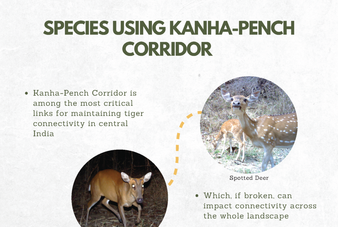
Species using the Kanha – Pench corridor
© PRASENJEET YADAV
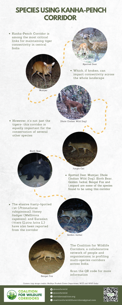
Illustration: Raiva Singh
© PRASENJEET YADAV
Illustration: Raiva Singh

© PRASENJEET YADAV
Dr. Divya Vasudev, from Conservation Initiatives, was recently awarded the Maxwell Hanrahan Foundation award in the Field Biology category. We spoke with Divya about corridors, her work, and her experience working in India’s Northeast and Western Ghats.

You were recently awarded the Maxwell Hanrahan Foundation award in the Field Biology category. Congratulations! What have been some of the other highlights on your conservation journey? And what inspired you to work in wildlife conservation?
Thank you so much! It was completely unexpected and is such an honour!
I was not one of those who always knew I wanted to be in this field, I guess I just drifted in. I liked the outdoors and I loved watching monkeys – bonnet macaques, to be specific – playing, interacting with each other, ever-curious, always up to something. This drew me to the post-graduate wildlife course at NCBS. When I joined the course, it was somewhat of an adventurous step into the unknown. By the time I completed the course, I was immersed in the field and could not imagine myself doing anything else! Two things continue to inspire and motivate me: one, the immense pleasure I get from being in the wild; and second, the knowledge that we are losing wilderness on a daily basis.
If I think about a few other huge influencing factors on my life, one would be my venture into the still relatively unexplored Northeast India two decades ago. The Northeast provides fascinating landscapes to explore and a diversity of human–nature relationships to understand. And, I’ve had the most amazing role models and guides: one of them, the incomparable Dr. Robert Fletcher—my Ph.D. advisor—who didn’t make my doctorate easy by any stretch of imagination, but I came out a much improved scientist, and in my own assessment, a better professional; Dr. Ajith Kumar, who is a pillar of strength and someone I have always turned to for advice and guidance; and Dr. Ullas Karanth, my first boss after my Ph.D. Dr. Karanth gave me the space to explore and shape my own research and conservation program, while also providing support and the most uncannily useful advice when I needed it! And many more people I cannot list here.
What inspired your interest in primates and elephants? And what ultimately led you to working in wildlife corridors?
My interest in monkey behaviour preceded my interest in conservation, actually. I’ve always been fascinated by how animals behave, how they interact and how they respond to cues. This, combined with a motivation to work towards conservation led me to work on dispersal and corridors. I guess it is also the knowledge that somewhere, we have some sort of formula for protecting our core wildlife populations—stop poaching, preserve habitat, don’t allow encroachments or clearances. But we are still searching for answers when it comes to dispersal and connectivity conservation.
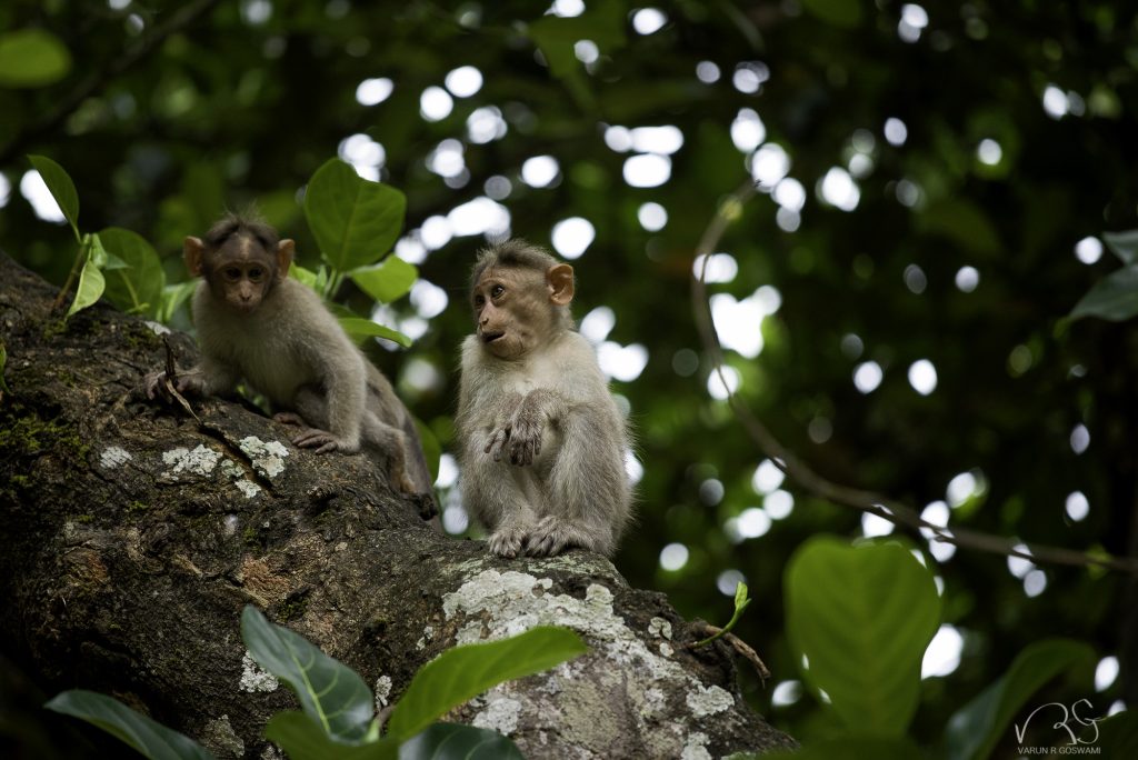
What is Conservation Initiatives doing towards the conservation of wildlife corridors in Northeast India?
Conservation Initiatives is a science-based conservation NGO that I co-founded with my colleague and husband, Dr. Varun R. Goswami. We both think it is important to work on landscape-scale conservation, which includes both the preservation of viable wildlife populations, and connections between these populations.
At Conservation Initiatives, we do a few things towards connectivity and corridors. In the Kaziranga landscape, our work focusses on elephants. Elephants are wide-ranging, it is in their ecology to move. When they move, they come into contact with people, and this sometimes can lead to conflict. There is therefore, a clear interaction between connectivity and conflict—we work to address this. How can we allow free and unimpeded animal movement, while minimising conflict and negative impacts on people? We do this by answering questions related to animal movement and human–wildlife interactions through research—where do animals move, why do they choose certain paths over other, what triggers conflict, what are the consequences of conflict for people and animals? We also work with people who live with animals—currently our work is focussed on tea estates, a major large landholding in Assam—to collectively figure out ways in which we can facilitate connectivity while minimising conflict. Additionally, we work in the hill states of Northeast India, towards supporting communities in managing their forests. These forests are of differing sizes, but even the small patches of forests are important in the larger green network.
In some of the corridors you have worked in, be it in the Northeast or in the Western Ghats, how do local stakeholders perceive these spaces? Are they aware of it being a ‘corridor’?
Oh yes, they are! We’ve been to a village right in the middle of a corridor, a space where there is a narrow gap of agricultural land between the grasslands of Kaziranga and forests that stretch into the Karbi Hills to the south. People who live there have given up farming rice—“when we plant rice, elephants eat it up, so what’s the use?” But they also recognised that their location was on a corridor, and that elephants, by their very nature, move. Further, Kaziranga is a floodplain ecosystem, and the Brahmaputra river floods annually to inundate it; when this happens animals need to move, and everyone who lives there is aware of this.
In other cases, people are not as attuned to the connectedness of lands. Take, for instance, the tiger that was recently shot dead in Almora, or the elephants that dispersed into Hassan. These are all connected areas—tigers can move up to 300 km and such long-distance dispersals are critical for genetic viability. Yet we often refer to these dispersers as ‘straying animals’, and sometimes shoot them or take them into captivity. We don’t know as yet what the consequences of these actions are on wildlife populations.
To you, what are the foreseeable challenges in maintaining habitat connectivity in India at large, and in Northeast India more specifically?
Maintaining the human–wildlife interface, for sure. India’s protected areas and natural ecosystems are, for the most, fragmented, and interspersed with multiple-use lands—lands that people and wildlife share. We’ve always lauded ourselves as being tolerant to animals, and allowing them on ‘our’ lands. But this part of our identity is steadily eroding. Animals disperse through lands that people use—for agriculture, extracting forest produce, residing. We need to figure out how to balance people’s and wildlife needs in these places. But, the consequences of a loss of wildlife connectivity will not always be immediately detectable, and fire-fighting conservation may mean that connectivity remains an overlooked wildlife need. Which brings me to the other big challenge—we need to mainstream wildlife connectivity into policy.
Is there a relationship between corridor loss and human-elephant conflict?
Increased fragmentation—breaking up—of habitat means an increased human–wildlife interface. Forest fragmentation also means that wildlife need to travel more through lands used by people, to access resources. An increased human–wildlife interface, for animals like elephants, can lead to increased conflict. There is a direct connect therefore, between conflict and connectivity. This is well recognised—we did a review of human–elephant conflict studies across Asia and found that solutions related to habitat consolidation and corridor preservation were often cited across studies. But these remain recommendations on paper, while we instead opt for conflict mitigation measures that, ironically, can block connectivity—e.g., fences, capture of dispersing animals.
Basically: (a) habitat fragmentation increases the human–wildlife interface and has the potential to increase conflict; while (b) conflict mitigation measures can block connectivity and impede animal movement across corridors.
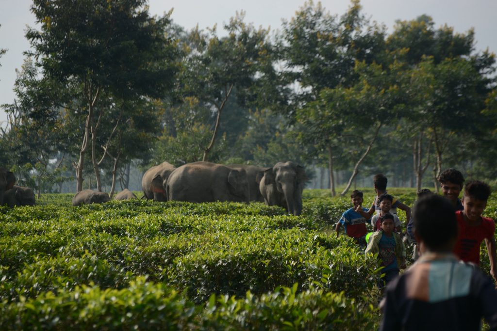
When one hears the word ‘corridor’, we typically think of a strip of forest in between two forest patches. But in reality, India has a mix of human-modified and natural corridors. Given fragmentation, how can we sustainably maintain these multi-use corridors?
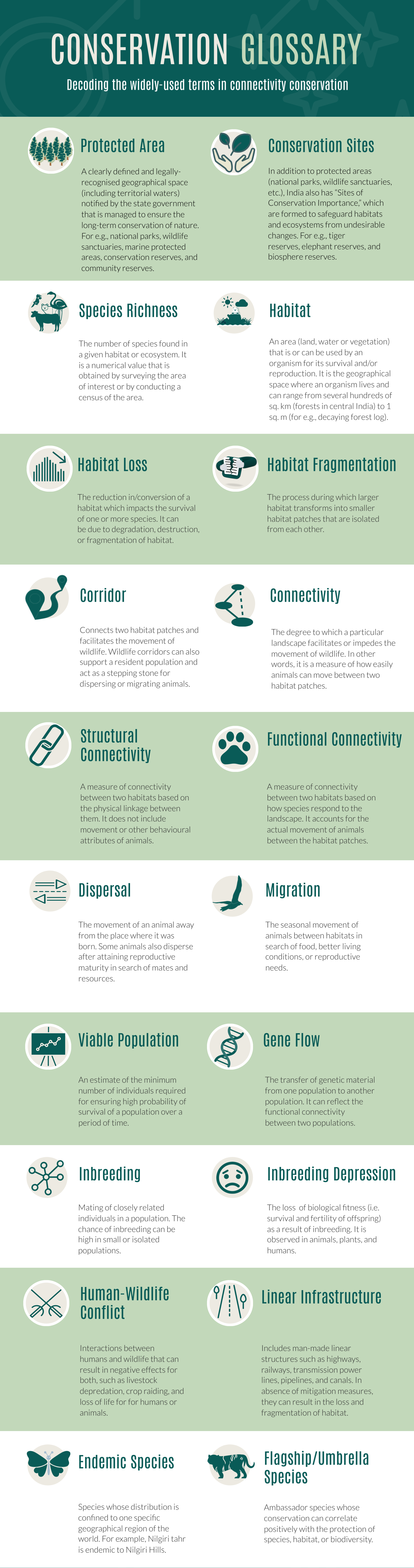
I hope all of us who are working towards conservation on these lands can come up with solutions, but here are my few thoughts. One, there are forested corridors and these are important. They may not be primary forests, and may not host high-density populations of species, due to which they are sometimes not accorded the highest degree of protection. Yet these forests are important and forest loss or clearance in important corridors should be avoided. Two, we all know the impacts of linear infrastructure—roads, railways, canals and powerlines—on connectivity. Animals like lion-tailed macaques or hoolock gibbons which are arboreal see these as breaks in canopy connectivity, while species like deer, jackals, and small cats frequently face mortality while trying to cross roads. These linear infrastructure need alternative alignments or mitigation measures. Three, we need to incentivise human actions that allow wildlife movement through multiple-use lands, and de-incentivise processes and factors that impede connectivity—through land-use planning, zonation and regulation of certain human activities. Lastly, we need to encourage and support science that can inform connectivity conservation.
As a conservation practitioner, what role can education and awareness play in corridor maintenance and conservation? Who are the key stakeholders that need to be engaged with and involved in this endeavour?
Dispersers move through lands shared with people. Hence, involving them—people who own, reside in, and work on lands important for connectivity—is critical. Education and awareness can bring knowledge and enhance support for connectivity conservation. It can help shed light on the consequences of corridor loss, and the impact of human behaviours and actions on wildlife. Yet, we need to go a step further and make efforts to transform that knowledge into wildlife-friendly action that is amenable to animal movement through such lands.
What are some of the learning tools you have used in University classrooms? And how have these tools helped in developing the capacity, skill and interest amongst the next generation, especially around corridors and connectivity (both inside and outside of the classroom)?
Students interested in ecology and the environment today generally are somewhat aware of connectivity and corridors, at least at a basic level. Being myself interested in conservation and practical implications of science, I try to encourage students to connect theoretical learnings with real-world incidents and contexts. With so much information at our fingertips through Twitter and WhatsApp, they often have the opportunity to be informed of incidents that capture our attention—e.g., road kills on highways. At an academic level, it is actually easy to understand the importance of connectivity, and of balancing people’s and wildlife needs. In some cases, students are surprised that mitigation measures on linear infrastructure, for instance, a proven solution, is not more often used on roads that cut through forests. What is more challenging is for me, colleagues and future generations to find ways to systematise nature conservation and connectivity into our overall discourse of progress. Only then will conservation of nature—be it preservation of ecosystems and species, or connectivity conservation—be truly and effectively achieved.
© PRASENJEET YADAV
Text: Vidushi Pant
© PRASENJEET YADAV
Illustration: Akshaya Zachariah & Text: Vidushi Pant
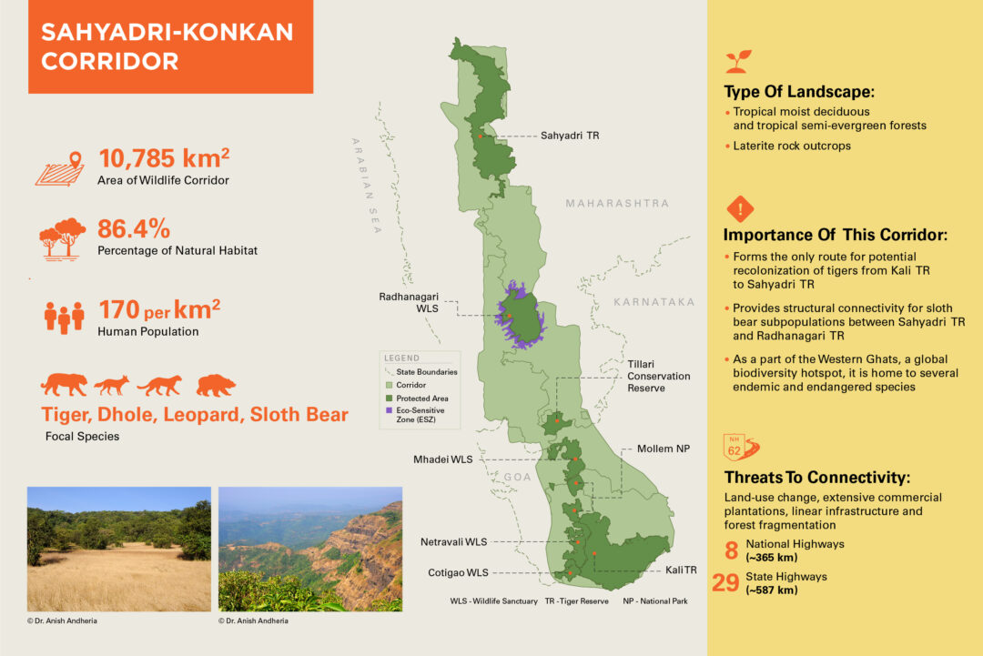
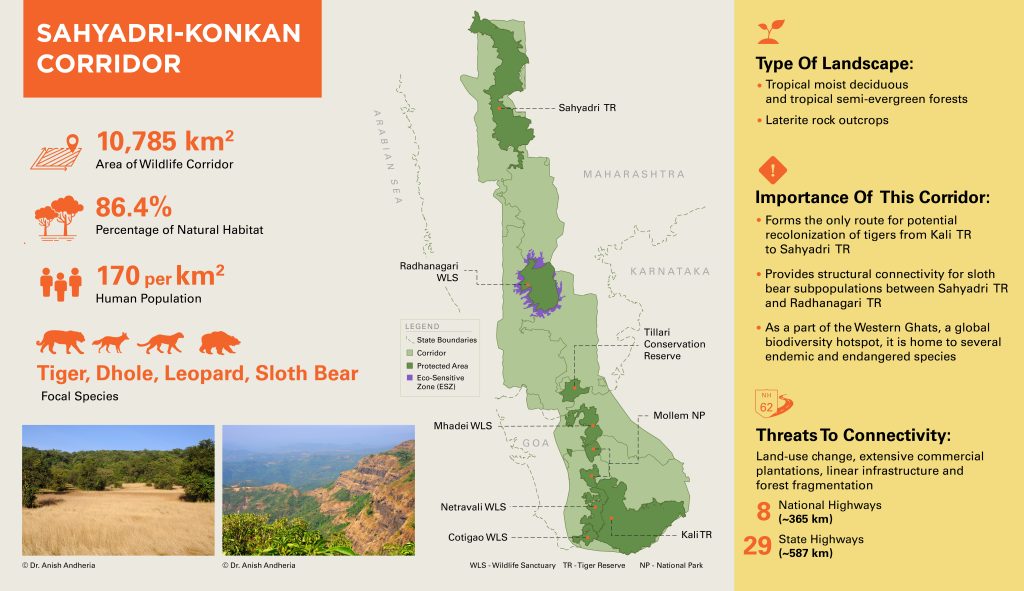
Nestled in the north central Western Ghats—a global biodiversity hotspot and UNESCO World Heritage site—lies the Sahyadri–Konkan corridor. It runs nearly parallel to the Western coast of India and spans across Maharashtra, Goa, and Karnataka. As the Western Ghats traps the moisture of winds from the Arabian Sea, they create a tropical climate along this region, which supports a wide array of endemic flora and fauna. Few sites within the corridor, such as Amboli and Tillari, often make headlines as several new species of amphibians, reptiles, and other taxa have been discovered here. Tillari is also critical as it forms a pinch-point for the movement of large animals, including tigers, from their source population in Karnataka to Maharashtra. The scenic landscapes and thriving biodiversity of these sites attract droves of researchers and nature enthusiasts.
Though this corridor houses picturesque hills, rocky plateaus, and dense forests, it is considerably fragmented. Moreover, large swathes of the corridor area in Maharashtra are dominated by private lands, which are under the constant threat of being transformed into cash crop plantations or other land-use types. Despite these challenges, several large animals use this corridor, including tigers, leopards, dholes, sloth bears, and gaur. For the survival of large mammals in this landscape, it is crucial that connectivity is maintained throughout the corridor.
To know more about the Sahyadri–Konkan corridor, have a look at Rizwan Mithawala’s conversation with Girish Punjabi, a wildlife biologist with Wildlife Conservation Trust, who has worked in this corridor for over a decade: Securing the Sahyadri-Konkan Corridor
© PRASENJEET YADAV
Harshad Sambamurthy
A corridor is a passageway. It is a channel that facilitates movement. And when applied to wildlife it serves as refuge; enabling their dispersal and permitting an ease of movement through fast-changing, fragmented habitat. As the expansion of linear infrastructure continues to crisscross forests, preserving and maintaining corridors is imperative.
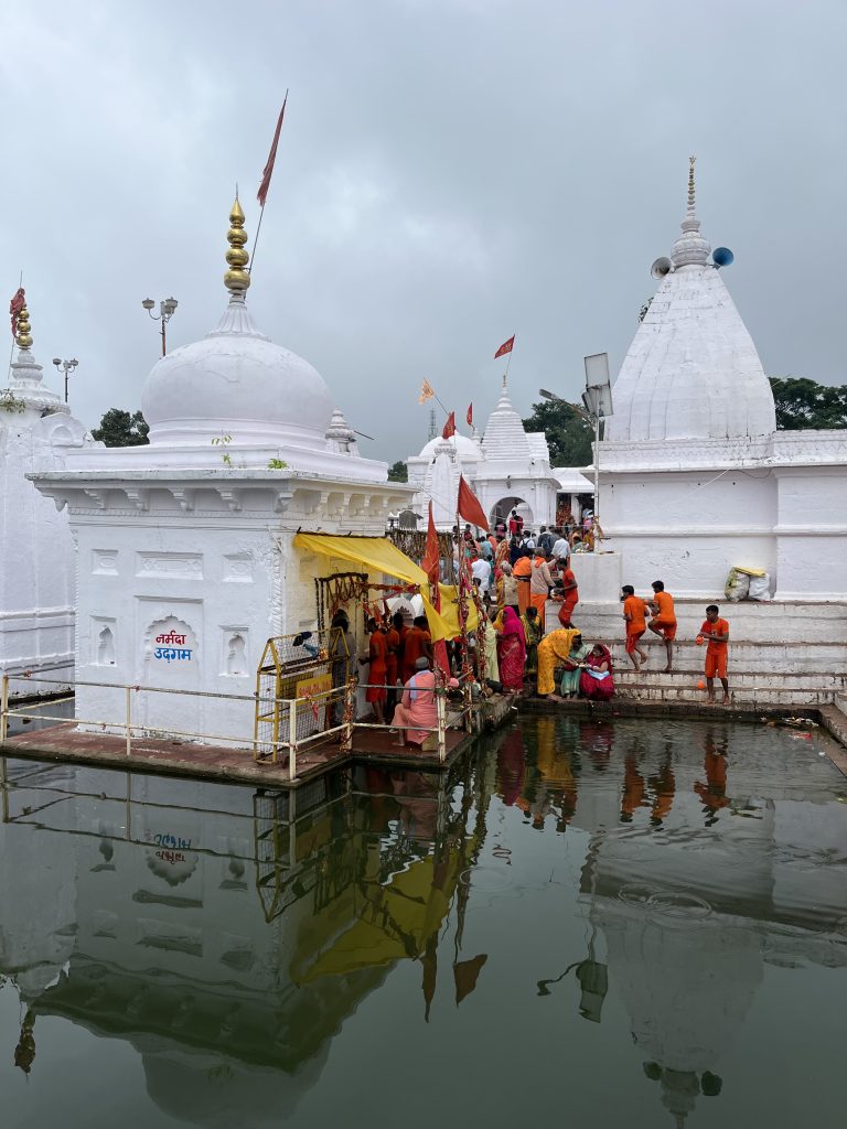
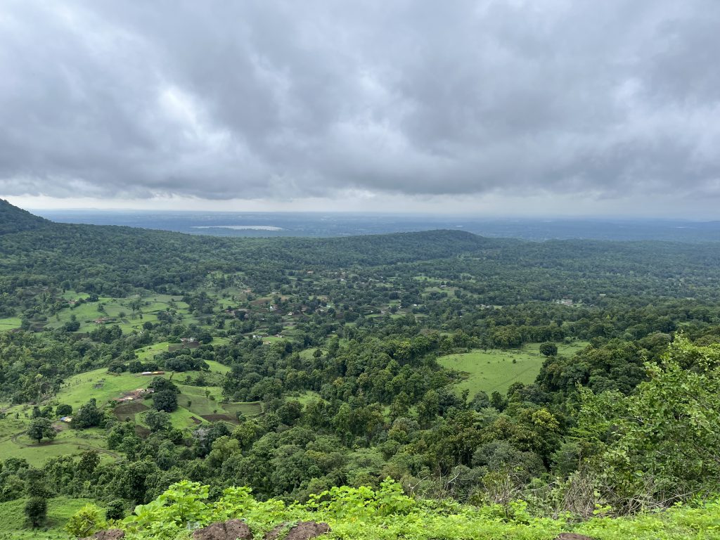
Recently, on a trip to Chhattisgarh and Madhya Pradesh, we travelled through the Achanakmar-Bandhavgarh corridor; traveling from Achanakmar in the south to Bandhavgarh in the north. Moving amongst dense sal forests drenched in monsoon-green, we arrived in Amarkantak on a stormy night. A pilgrim town, it serves as the beginning point of the rivers Narmada, Son and Johila. Last year, two tigresses had moved from Bandhavgarh Tiger Reserve to Achanakmar. One theory suggests they might have navigated along the Johila that stretches across the entire corridor. According to one forest official we met, Gaur are said to have used such a route more than ten years ago. The tigress’ movement underscores the importance of this stretch, and links corridor conservation to water security. Obstacles abound however, with mining and infrastructure development showing few signs of slowing down.
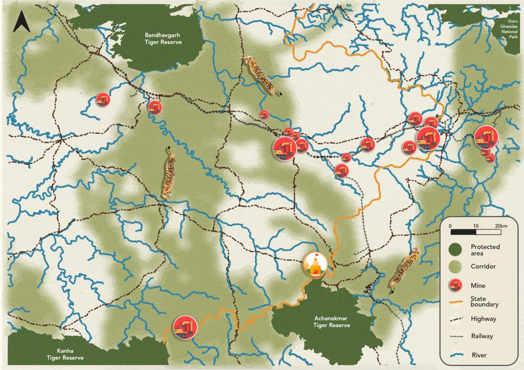
Recently, in May 2021, Madhya Pradesh’s Chief Minister, Shivraj Singh Chouhan, declared that no new construction will take place in Amarkantak; to help combat water contamination in the Narmada. This is a welcome decree, however, existing roads continue to thwart safe passage. In June, a smooth-coated otter was found dead on the State Highway between Amarkantak and Anuppur; a victim of roadkill. Scores of roadside eateries and dhabas along such roads use fulgent fluorescent bulbs at night that likely deter animal movement; who probably shy away from the overbearing, polluting light. Human settlements also attract dogs who prey on herbivores, like spotted deer. In the central part of the corridor, in Anuppur town, there is a thermal power plant, along with bauxite, dolomite, and granite mines. Open-cast coal mining occurs in the Bijuri range of Anuppur forest division. Here, there is confirmation of wayfaring elephants roaming through barren lands, an isolated population of Malabar giant squirrel, and a sloth bear population in Jathari range. Rich in biodiversity, striking the balance between environmental health and the execution of development priorities is pressing.
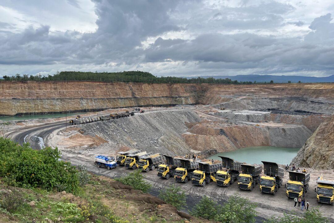
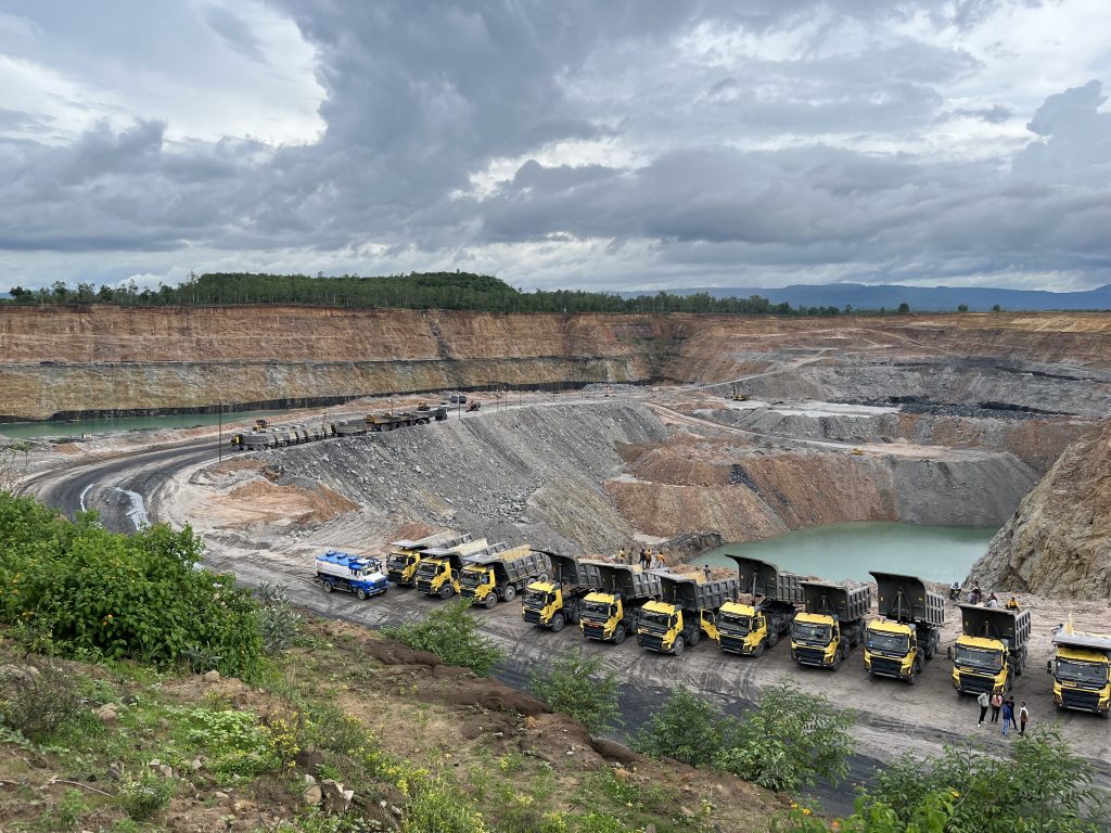
As we moved into the municipality of Dhanpuri in Madhya Pradesh’s Shahdol, we visited a coal field. This was part of the larger Sohagpur coalfield operated by South Eastern Coalfields Limited; the largest coal mine in Madhya Pradesh situated at the basin of the Son river. Terraced mountains of gravely sand towered above excavated ponds of foggy-grey, icy Ammaroo turquoise. Mustard-coloured trucks with black carriers were bunched together like a swarm of hungry wasps. Poignantly, isolated patches of clumped-together trees floated above these mounds like shattered chandeliers. With coal demand high, lengthy trains with charred carriages carry coal by the tonne along the high-priority coal freight corridor. Advocating alternative energy sources as a substitute for coal will likely be difficult in the short-term; given its essentiality for powering countless activities. On the other hand, shifting a corridor to allow for the expansion of coal is likely to lead to increased human-wildlife encounters as animals are forced to move in new directions using previously unexplored paths. This can have knock-on effects for communities who are not necessarily equipped to deal with wildlife.
As we continued North and approached Bandhavgarh, a jungle cat slipped past. Its silhouette caught in the glare of the headlight looked like a blanched apparition. Numerous resorts abound along the popular Tala zone. A multicoloured water park is one such bizarre construction. While meeting the Deputy Director of Bandhavgarh, he emphasised the vitality of “safe passage”, noting that infrastructure development in and around vulnerable villages—especially those new to elephant movement—is critical. He also highlighted the need for the construction of clearly visible, and strategic underpasses, concerned that there is little “free movement” for animals along highways or railway tracks, as the lethal combination of high speeds and few underpasses make it difficult to safely navigate across. Between Katni and Bilaspur, a triple railway line has now been approved with 8000 trees sanctioned to be cut in Umaria alone. Thus far, more than 4500 trees have been chopped. Given that a corridor is not officially notified, it makes passing environmental clearances for linear infrastructure projects that much easier and hassle-free. Presently, the roads between Dindori and Jabalpur, and Dindori and Mandla are being expanded, with forests on both sides of the road.
While traveling to Umaria, we sped past a crushed carcass of a jackal. Last year, in Ghunghutti range of Umaria Forest Division, a tiger cub was struck by a car along a blind corner on national highway NH-43. We visited this spot, and were told that mitigation measures have been put in place. This included straightening the road—not very noticeably—to reduce its curvature. While here, we couldn’t help notice the construction of a bridge over a two-lane railway track. In a span of fifteen minutes, three separate trains carrying coal trundled past. Roads and railways unfortunately kill numerous species, but these often go unrecorded, as these animals—blackbuck, pythons, langurs—do not command the media’s attention as much as a tiger or elephant kill probably does. Mitigation measures to avoid such fatal animal- vehicle collisions is perhaps well illustrated in the nearby Kanha-Pench corridor. A section of that corridor is cut by NH-44. To mitigate impact, five underpasses and four minor bridges were constructed to help facilitate the movement of wildlife.
Increasingly, large mammals like tigers and elephants are being documented outside designated protected areas. For example, tigers have been recorded within 2-4km of Umaria town. Wildlife also use farmland and crop fields as pathways. No more are they restricted to the boundaries of a designated national park, tiger reserve or wildlife sanctuary. Such movement patterns further underline the crucial role corridors play for wildlife dispersal. Basic awareness on corridors, and their utility must increase. Maintaining corridors is pivotal for wildlife conservation; encouraging animals to move between subset populations and promote genetic exchange, while also providing spaces for these animals to freely move without having to enter human-dominated areas for connectivity.
When a corridor is maintained, it often serves several species, not just the ‘charismatic’ few. Pushing for a moratorium on forest clearances for coal mining (Greenpeace, 2012), or advocating for stringent environmental impact assessments prior to highway expansion proposals might lead to more opposition than support. The case for conservation then, comes down to perceptions; the cornerstone of which is awareness. Along with awareness, calculating a corridor’s value will strengthen general understanding regarding its potential economic contribution towards the broader canvas of enriching India’s natural heritage. To embed corridors as a mainstay of conservation planning in Central India, practitioners must continue to facilitate dialogue and discussion between key stakeholders from the local community, the Forest Department, Railways Department, National Highways Authority of India, and Coal India Limited.
Forest department staff indicated that the maintenance and conservation of corridors is not always budgeted for in division-level workplans, despite there being a section on corridors in each Tiger Reserve’s Tiger Conservation Plan (TCP). Mapping and delineating the Achanakmar-Bandhavgarh corridor in the TCP will bring greater attention to its significance, apportion much-needed money for its monitoring and maintenance, streamline the process of preservation, and strengthen the legal framework for its conservation, in what is otherwise a vague definition at best in articulating the roles and responsibilities of who is responsible and accountable for its management. Notification will provide much-needed legitimation for corridors. Constitutional recognition of a corridor is necessary, but without increased, transparent dialogue among key stakeholders, the needle is unlikely to move, by which time, the corridors of Central India might be blackened by the fast-gathering clouds billowing from its depleting coal reserves.
© PRASENJEET YADAV
Harshad Sambamurthy
Ranthambhore has long served as the stock backdrop for the perfect tiger picture. As the erstwhile hunting grounds of the Maharajas of Jaipur, derelict lookout posts still remain; adding a novel, and deservedly royal touch to the tiger’s home. Culturally diverse, and rich in oral stories spun from the most attractive yarn; Ranthambhore has fast become synonymous with tiger tourism.
My fascination with Ranthambhore began in 2007 while volunteering remotely to help raise funds for the NGO Tiger Watch. This attraction gradually gathered pace after picking up my first book by the revered tiger conservationist Valmik Thapar, and the subsequent urge to visit the forest surged ferociously, but due to the inaccessibility of being based elsewhere; was suppressed; resigned to remain dormant, patiently awaiting to pounce upon the opportunity which eventually presented itself fourteen years later.
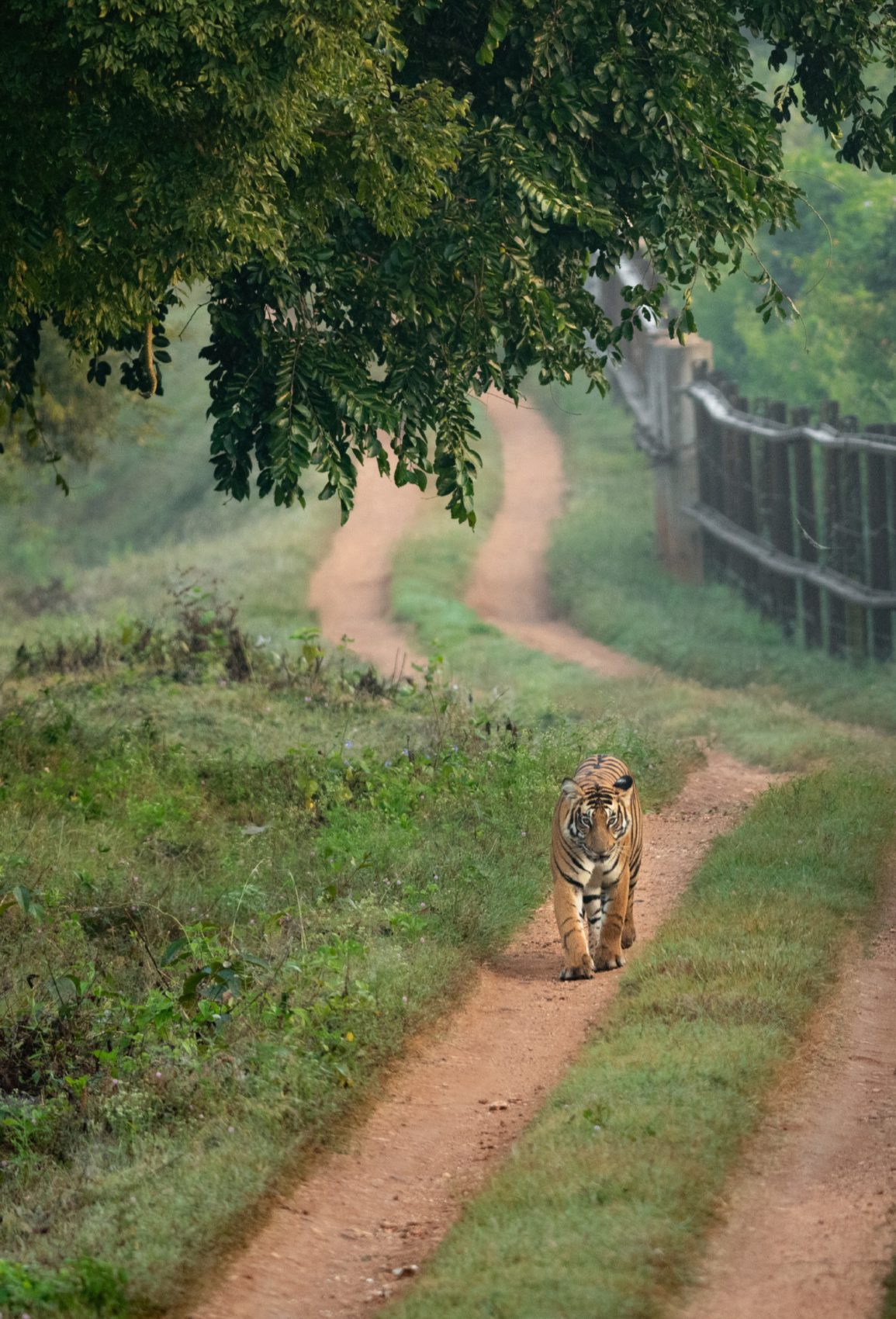
Arriving in Sawai Madhopur—the nearest town to Ranthambhore—the tiger’s face is plastered across every imaginable space of wall, and the surfeit number of gypsy jeeps and canter trucks demonstrates the pull of the tiger. The frequency of these images however, are in distinct contradiction to the reality of spotting the actual animal. While there, I visited the park, but the forests stood eerily quiet. Apart from a bulky sambar stag foraging in a distant clump of bush, it was difficult to accept that other animals existed in the reserve. Returning from the afternoon’s excursions, vexed at my tiger-less outing; it was mildly comforting to hear that other tourists were equally luckless. Some scowled with displeasure, while others bore their confoundment plainly; lamenting their fate.
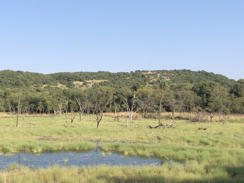
Despite my ill-luck, the forests are home to large carnivores like tigers, leopards and bears; smaller predators like the caracal, desert cat, and prey like sambar, chital (spotted deer), chinkara (Indian gazelle) and wild boar. Yet, perhaps catalysed by burgeoning tourist pressures, the larger Ranthambhore landscape is rapidly changing. The unsustainable usage of non-timber forest products; illegal sand, gravel and stone mining; the construction of linear infrastructure; and the spread of invasive weeds like Prosopis Juliflora are dramatically remoulding the landscape’s entire appearance. Prosopis was introduced in the 1980s; aimed at providing firewood to communities in the Chambal region. Planted along with other species in the name of restoration and to disrupt the movement of bandits, was discontinued in 1995, but having taken root, its spread has been ubiquitously devastating.
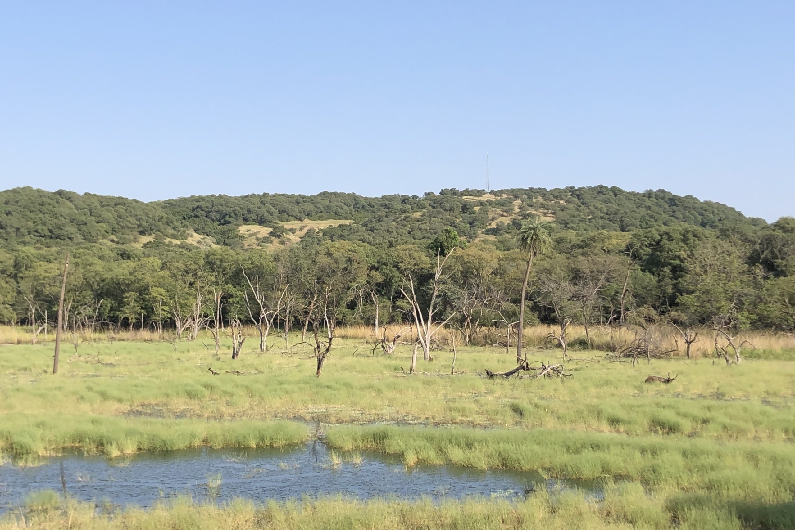
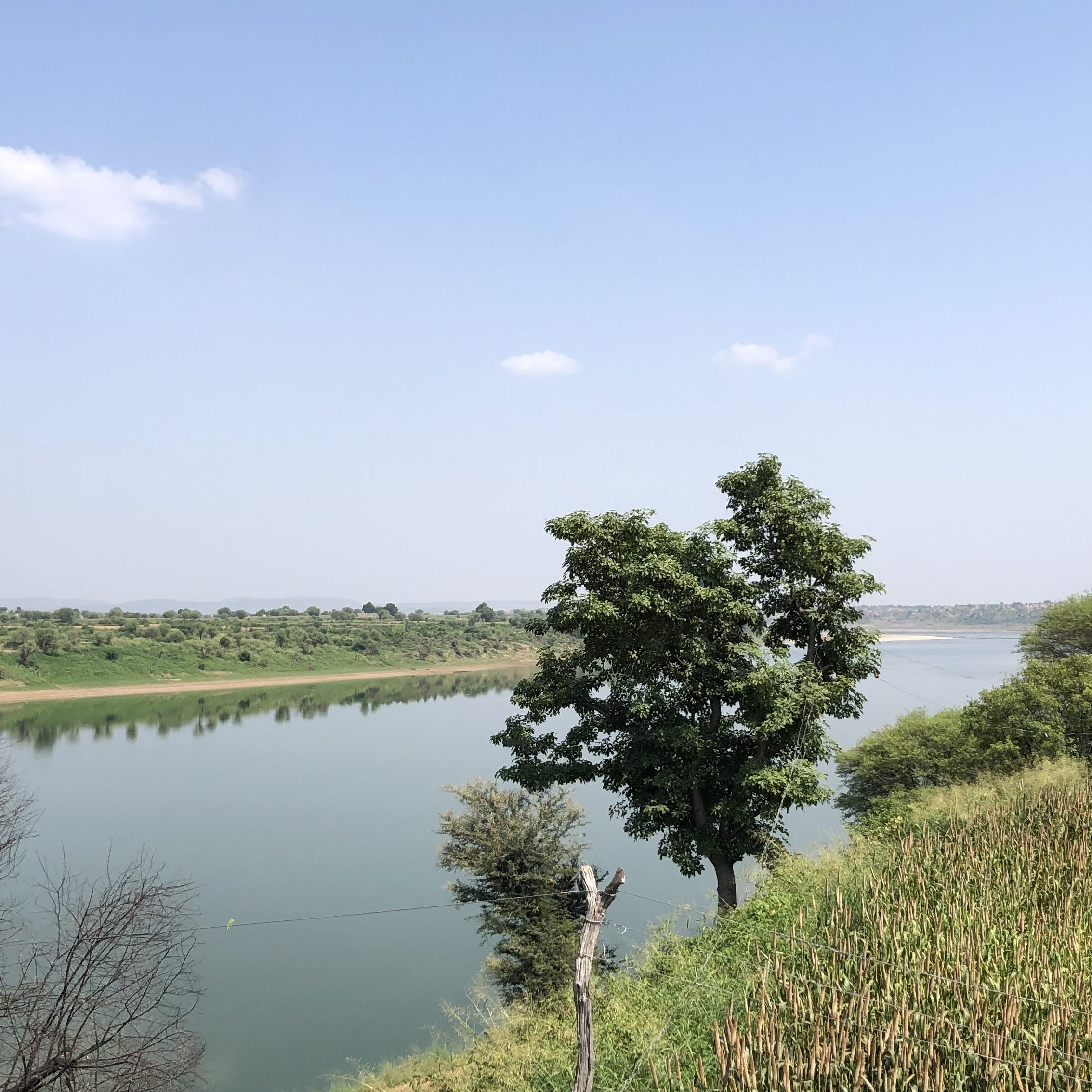
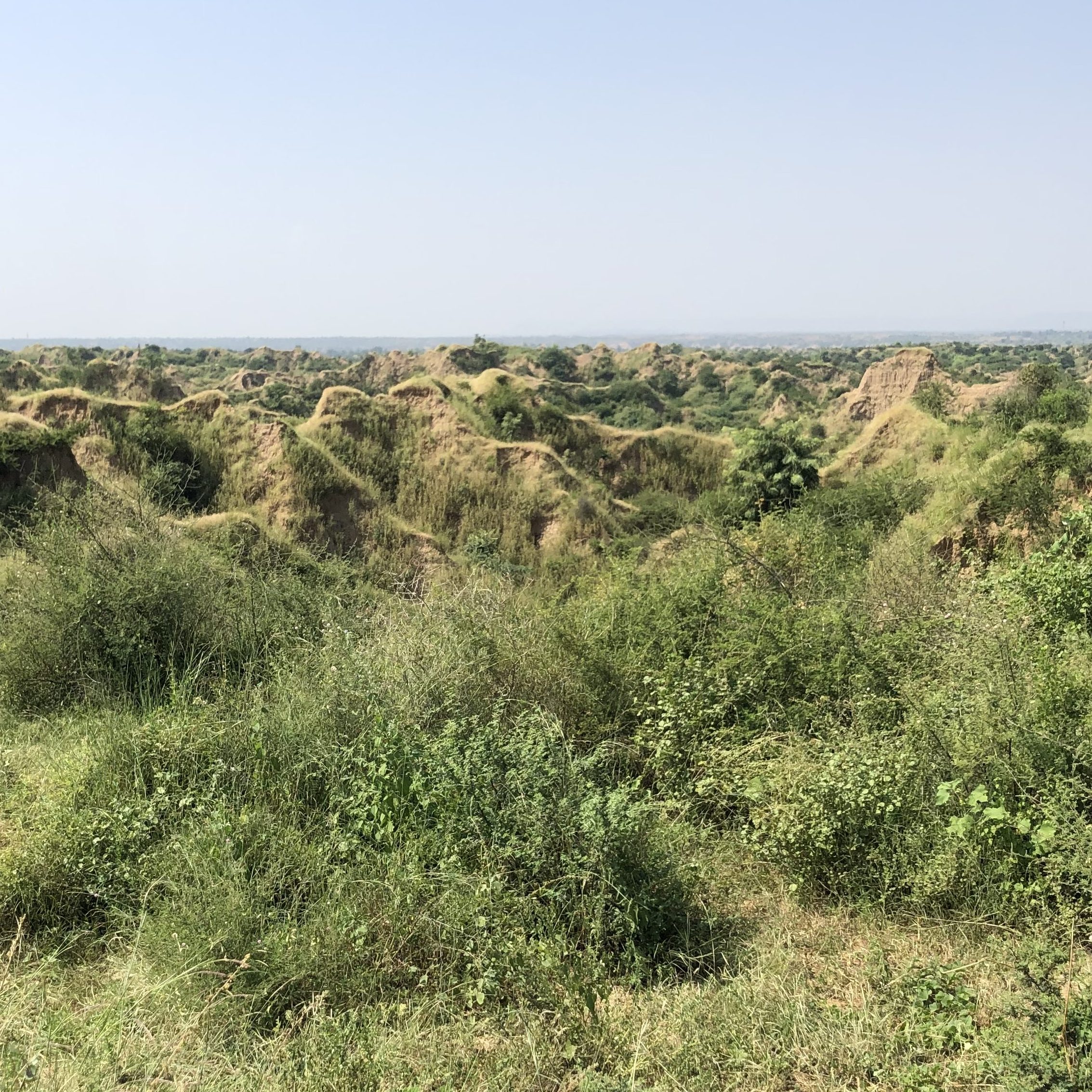
The tigers here; genetically distinct and suited for the harsh climate are predominantly concentrated in and around Ranthambhore National Park and Tiger Reserve. Tigers require large home ranges however, and often disperse through wildlife corridors. These corridors are essentially routes that promote the movement or migration of animals between connecting habitat patches; often used to expand home ranges and support genetic exchange. Maintaining these crucial dispersal pathways— that are swiftly succumbing to agricultural pressures and being squeezed into tinier slivers—is imperative for landscape-level conservation projects. Ranthambhore’s tigers prefer to move, and do so in three different directions. Their movement Eastward through the Ranthambhore-Kuno Corridor (RKC)—perhaps more vital because it connects them with other tigers in Madhya Pradesh—was what piqued my interest. Leaving Sawai Madhopur, our four-person WWF India team traveled towards Sheopur, in neighbouring Madhya Pradesh, and onwards to Kuno Wildlife Sanctuary. En route, we crossed the glorious Chambal; its ripples glimmering in the noon shine; then alongside deep, jagged and precipitous ravines that keep hidden a panoply of creatures; and thereafter, the mesmerising greenery of the Sheopur forest division—where we spotted a flock of vultures feeding on the innards of a buffalo corpse—on a near perfect linear stretch of asphalt.
Our colleague Sonu was wearing a Kuno Wildlife Sanctuary shirt which had the illustrated face of a lion as the emblem. I was rather perplexed, for I thought the Asiatic lion was only found, isolated, in Gir National Park, Gujarat. The late Maharaja of Gwalior believed that lions once roamed over the territory of his state and was determined to reintroduce them; importing three pairs of African lions for an “experiment” in the Sheopur-Shivpuri forest division (Singh, 1959). With the lions initially kept in an enclosure, they were gradually released. One such lion was found dead in an open expanse, badly mauled, with the incisive precision characteristic of a tiger. Col. Kesri Singh—the former in-charge of the Shikarkhana (hunting department) for Jaipur and Gwalior—contended that tigers are the stronger animal. When he organised private shows that pitted a lion against a tiger, the lion would first strike, and instigating the tiger’s wrath, swift swooshes of the tiger’s forepaws made the lion retreat. With the tiger unwilling to pursue, the bizarre spectacle abruptly concluded. As tigers are known for their infamous intolerance of foreign incursions into their territory; Singh maintained—and this is unverified—that the tiger was responsible for the near extermination of the lion in India; killing it wherever it encountered the other big cat. The lions, he believed, were eventually forced to seek refuge in Gir, which is separated by more than 150 kilometres of difficult terrain from the tiger’s nearest stronghold (Singh, 1959). A local sarpanch (an elected decisionmaker), in the village of Ghugus Gaon; just outside of Birpur, Madhya Pradesh told us that tigers perhaps existed in Kuno in the 1960s. Clad in a loose white banian and punctured dhoti, he explained in a low drawl, in between sips of milky tea, that tigers still move through the RKC; utilising the cover and extensive labyrinths of the deep ravines as a passageway. With a grimace of concern, he bemoaned the mounting development pressures, warning that the number of tigers using this corridor are likely to reduce.
Just as lions might have sought sanctuary in Gir, away from the territorial terror of the tiger, wildlife are now contained—so to speak—in present-day sanctuaries, national parks and protected areas; that are fast becoming green blotches in the larger canvas of development. These scattered patches of connecting forest that serve as habitats in a rapidly-changing mosaic are now those same corridors that require maintenance and preservation. Wildlife corridors provide important dispersal pathways for animals, and serve as an ecologically-sensitive buffer region at the edge of a protected habitat. With human habitations extending near to—or sometimes inside—forested-areas, the possibility—and concomitant probability—of human-wildlife interactions increasing can have detrimental consequences. Corridors can help cushion and absorb the impact of such interactions; especially if they were to become negative. The corridor—like a string that connects the various natural pearls it holds—is part of a larger concatenation; linking the animals it allows to freely move with the communities and livelihoods they rely upon. In India, where sharing spaces with wild animals is as natural as the changing of seasons, the continued preservation of wildlife corridors—like the RKC—can ensure secure mobility of migrating fauna and the promotion of genetic exchange, while concurrently granting humans the space to safely negotiate these areas; giving voice to the language of co-existence.
Bibliography
Corridor Profiles is an initiative by the CWC to create an extensive repository of information on habitat corridors across India. Each corridor profile is a regularly reviewed and updated report that contains in-depth information about the corridor. Data is collected from scientific literature, reports, and expert professionals, and includes information on various attributes of the corridor such as geographical features, wildlife use, human settlements, threats, conservation efforts, and more. A uniform format makes it easy for the user to extract diverse data across all corridors. This information is available to policy makers, researchers, students, and anyone interested in knowing more about habitat corridors in India.
Links to some corridor profiles
Bandhavgarh- Nauradehi Corridor: https://corridorcoalition.org/Profiles/CorridorProfile_Bandhavgarh_Nauradehi.pdf
Dudhwa- Kishanpur Corridor: https://corridorcoalition.org/Profiles/CorridorProfile_Dudhwa_Kishanpur.pdf
Kallar Corridor: https://corridorcoalition.org/Profiles/CorridorProfile_Kallar.pdf
Kanha- Pench Corridor: https://corridorcoalition.org/Profiles/CorridorProfile_Kanha_Pench.pdf
Mount Abu- Jessore Corridor: https://corridorcoalition.org/Profiles/CorridorProfile_MountAbu_Jessore.pdf
Pench- Nagzira Nawegaon Corridor: https://corridorcoalition.org/Profiles/CorridorProfile_NagziraNawegaon_Pench.pdf
Pench- Satpura Corridor: https://corridorcoalition.org/Profiles/CorridorProfile_Pench_Satpura.pdf
Ranthambhore- Kuno Corridor: https://corridorcoalition.org/Profiles/CorridorProfile_Ranthambhore_Kuno.pdf
Sahyadri- Konkan Corridor: https://corridorcoalition.org/Profiles/CorridorProfile_Sahyadri_Konkan.pdf
Satpura- Melghat Corridor: https://corridorcoalition.org/Profiles/CorridorProfile_Satpura_Melghat.pdf
Apart from the detailed downloadable profile, users can also view a quick glimpse of the corridor status through 8 principal indicators –
| Area of natural habitat | Human Modification Index score |
| Area under legal protection | Landscape Complexity |
| Species richness | Land Use Change |
| Average human population | Fragmentation |
View and download corridor profiles here
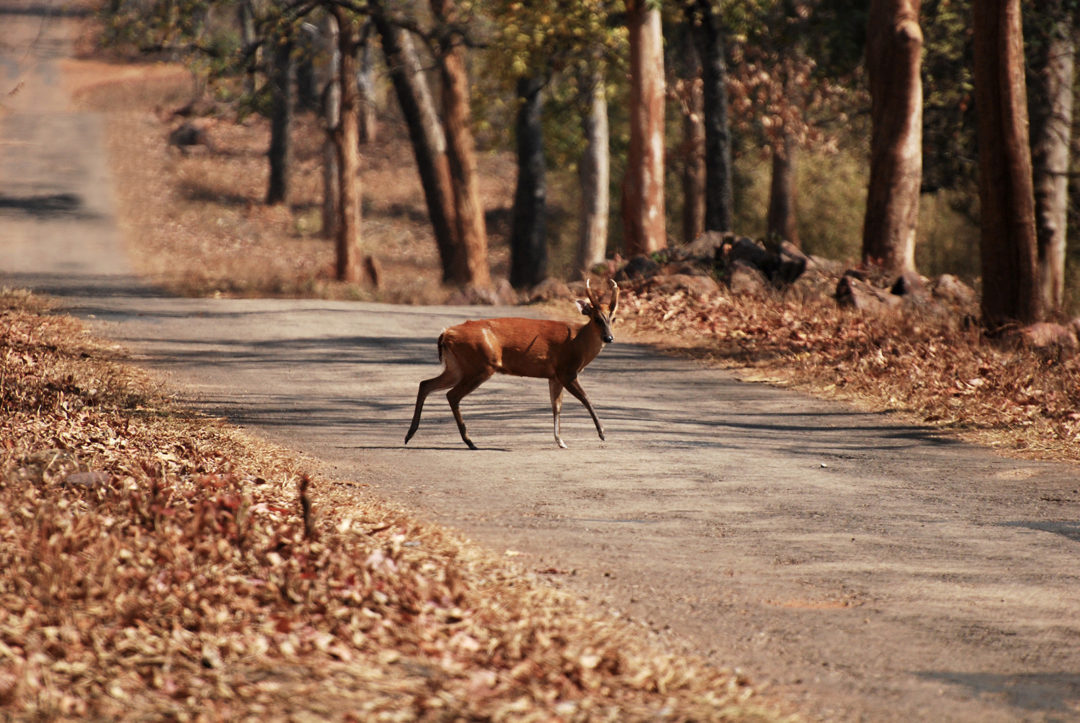
‘Connectivity conservation’ is increasingly being recognized as critical to species conservation and planning. A recent review analysed the trends in the literature, identified gaps, and highlighted future directions. The review was carried out by a team of scientists from the World Wide Fund for Nature- India (WWF- India), The Shola Trust, Network for Conserving Central India (NCCI), National Centre for Biological Sciences (NCBS) and Indian Institute of Science, Education and Research (IISER)- Tirupati. The Coalition for Wildlife Corridors helped in bringing together some of the scientists and coordinating the effort.
Some of the key findings of the review are:
Link to the paper: https://link.springer.com/article/10.1007%2Fs41745-021-00240-6
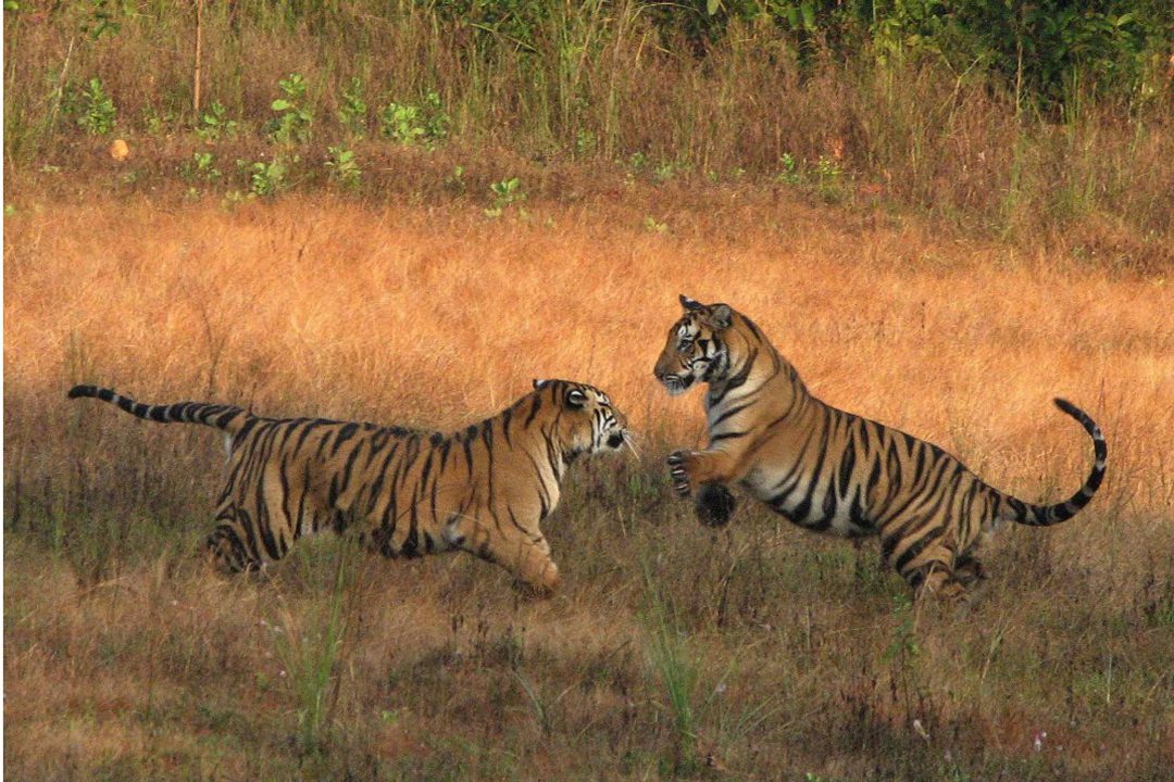
Effective conservation planning and management is crucial to secure corridors and maintain long-term functional connectivity between habitat patches. The Coalition for Wildlife Corridors aims to work at the science, policy and practice interface to strengthen the planning, design and implementation of corridor management plans that are key for achieving conservation success. Currently we have two linked initiatives focused on conservation planning:
The Government of India recognizes the importance of conserving corridors, and this is reflected in the National Wildlife Action Plan 2017-31 as well as the guidelines for making Tiger Conservation Plans (TCPs) that are required to be developed for all declared TRs under Section 38V of the Wildlife Protection Act. TCPs provide a roadmap for conservation action from each TR and include a section on dispersal habitats and corridors for connectivity with other protected areas. NTCA has provided extensive guidelines for making corridor conservation plans as part of the TCPs. As a preliminary step towards strengthening corridor conservation planning, we are analyzing the corridor sections of TCPs to identify opportunities for improvement, verify incorporation of NTCA recommendations, and align TCPs with current global standards. We hope to develop a framework to increase the synergy between TCPs of tiger reserves that share a corridor to reduce redundancy in efforts and increase the overall efficiency.
We see TCP assessment as a preliminary step that will be followed by a series of focused workshops for specific corridors, whereby the applicability and feasibility of the recommendations can be thoroughly discussed, which will ultimately contribute to strengthening the connectivity component of TCPs. These workshops aim to facilitate exchange of ideas and to understand priorities among diverse stakeholders, including the Forest Department, other line departments, central government agencies, the Coalition partners, and other NGOs active in the landscape, thereby providing a panoramic perspective of the status and helping discern potential solutions.
We partnered with the Madhya Pradesh Forest Department to organize the first such workshop for the Satpura-Pench and Satpura-Melghat corridors in Pachmarhi in June 2023. Read about the workshop here.
A recent global review of corridor conservation plans (Keeley et al. 2019) identified a few common attributes for successful implementation of a plan: 1) involvement of key stakeholders, from government to private landowners, throughout the implementation phase to achieve results on the ground, 2) supportive government policies and laws that facilitate implementation and encourage necessary funding, 3) leadership continuity and minimizing the turnover of staff/ people involved in implementation, and 4) use of a transparent and repeatable scientific approach. The Coalition for Wildlife Corridors aims to aid better implementation of conservation plans by focusing on these identified attributes.
In view of the multi-use nature of most corridors in India, it is essential to sustain collaborations among stakeholders during the implementation phase of the conservation plans. Acknowledging the issues and outlining potential solutions constitute the first stride of multi-stakeholder engagement for corridor conservation. The NTCA guidelines suggest mechanisms for forming a working multi-stakeholder committee for efficient corridor conservation. We aim to work closely with the Forest Department to ensure that active committees are formed for all corridors to ensure robust implementation of conservation plans. We aim to facilitate the implementation of conservation strategies by spearheading capacity building workshops for frontline forest staff, curating best practices that serve as a valuable resource for informed decision-making, and facilitating the incorporation of TCPs into working plans of forest divisions. We aim to provide crucial support for incorporating more science in the conservation plans by developing indicators and rigorous monitoring mechanisms, sharing crucial evidence about the wildlife use, and identifying the extent or boundaries of corridors and critical areas within them. Lastly, we also aim to engage in proactive outreach and advocacy to breathe life into the recommendations developed during corridor conservation planning.
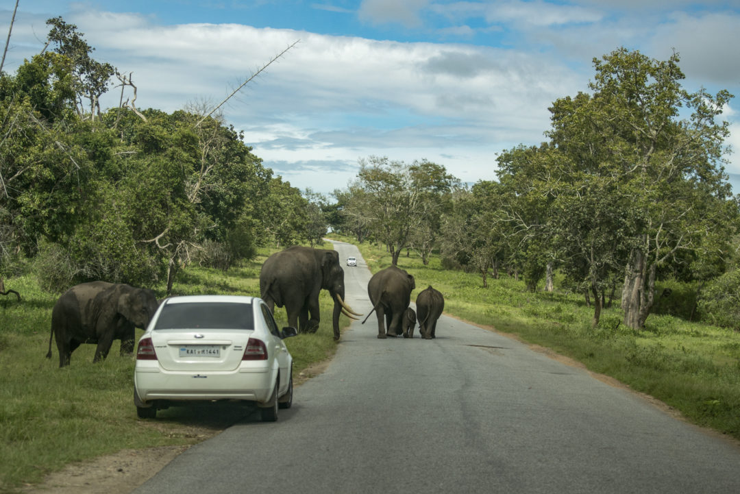
Many species are known to use the corridors that often comprise patches of natural habitat embedded in a matrix of plantations, agriculture and villages. Although these areas are currently permeable for wildlife, land use change in the future is likely to break connectivity. There is no law in India which specifically defines wildlife corridors, or prohibits development within, and around them. With a focus on engaging with multiple sectors to ensure corridor conservation, the white paper will discuss possible mechanisms of land use change regulation within corridors and ways to incorporate suggestions in land use change policy.