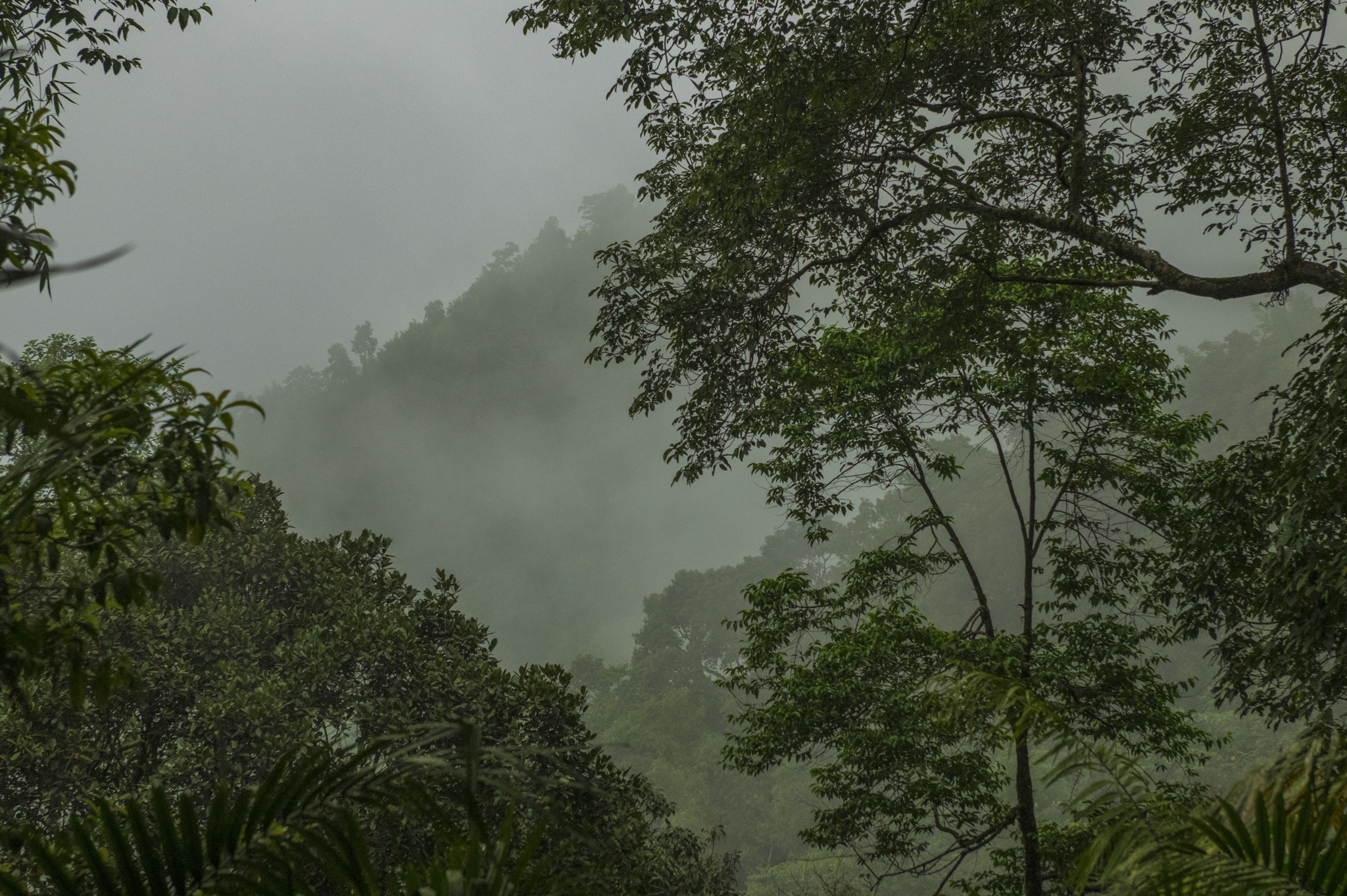
Why Conserving Corridors is Crucial for Safeguarding Water Resources?

Why Conserving Corridors is Crucial for Safeguarding Water Resources?

© PRASENJEET YADAV

Vidushi Pant

Since it first gained popularity in the early 1990s, the term “landscape connectivity” has gradually made its way into the lexicon of wildlife conservationists and policymakers alike. In simple terms, landscape connectivity measures how well different areas in a landscape are connected to each other. It has mostly been studied for its role in facilitating the movement of iconic animals such as grizzly bears, jaguars, tigers, and elephants, as they move around in search of mates, food, and other resources. The passageways—or areas with high landscape connectivity—used by animals are more popularly known as “wildlife corridors”. Some famous corridors include the trans-boundary Yellowstone–Yukon Corridor that traverses across the United States and Canada, Serengeti-Mara Corridor that spans across Tanzania and Kenya, and the Kanha–Pench Corridor in Central India.

However, wildlife corridors are not just highways for animals. These corridors influence various biotic and abiotic flows between two or more habitats, affecting everything from seed dispersal to water movement and even the spread of wildfires and diseases in some cases. These flows on the land surface, below ground and through the atmosphere, can have consequences that ripple beyond the wilderness and contribute to human well-being and in some cases hazards as well. Take, for instance, their potential role in safeguarding the water resources in a region. As wildlife corridors often include large swathes of natural or semi-natural habitats (such as forests, grasslands, and agriculture-forest mosaic), they can play a crucial role in safeguarding the water resources in watersheds, shielding them from sedimentation, contamination, and flood risks and also contribute to rainfall in neighboring regions through recycling of transpired water from vegetation.
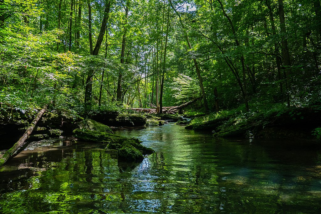
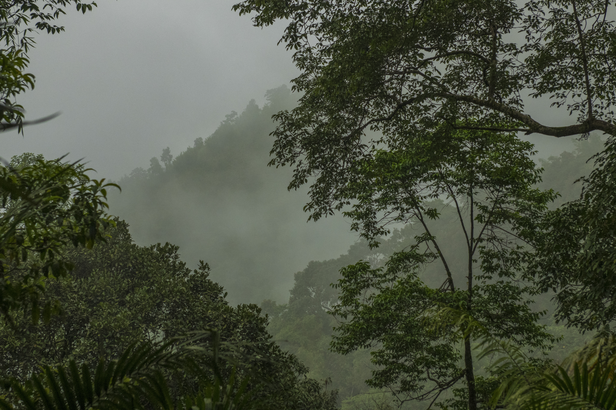
River in a forest. Photo credit: Rakielle via Wikimedia Commons

Given this potential association between wildlife corridors and water resources, it is only fitting to inquire whether this relationship has received comprehensive attention in the existing body of literature.

A recent study by scientists from India and the United States reviewed the degree to which the hydrologic function of wildlife corridors has been assessed in literature and conservation practice. The authors assessed the literature on connectivity using a bibliometric analysis, which is a quantitative research method used to evaluate and analyze scholarly literature to identify the trends in studies. They analyzed 3600+ research papers published between 1990 and 2023 and reported that only limited studies on landscape connectivity have addressed hydrology (with only 15 studies in 2022). About 50% of the publications that address wildlife or biodiversity along with hydrology or watersheds were published after 2015, highlighting the early stage of this thematic research area. Further studies are warranted to reveal how landscape connectivity for wildlife corridors can affect watershed protection in different landscapes.

Central Indian Highlands: A Case in Point

To underpin the synergy between wildlife corridors and hydrology, the authors also included a case study of the Central Indian Highlands. These highlands comprise a series of different hill ranges and plateaus, and are a part of the larger Deccan Plateau, spanning across Madhya Pradesh and parts of Maharashtra and Chattisgarh. They boast a diverse landscape, featuring dense forests, rolling hills, deep valleys, and numerous rivers and streams. This region also supports a rich biodiversity and has been a focal point for tiger conservation in India and houses several famous protected areas such as Kanha National Park and Pench, Melghat, and Satpura tiger reserves, among others.

Notably, the headwaters for several major rivers, including the Narmada, Tapti, Wainganga, and Pench rivers lie in these highlands. These rivers are vital for providing water resources to downstream areas, which have been home to indigenous communities and tribal populations for centuries. However, a previous study has reported that about 74% of the area of the Central Indian Highlands experienced water stress for a minimum of four months every year between 2004 and 2012. Water security in this region—as with several areas in India—has been recognized as a critical issue by policymakers, civil society organizations, academics, and researchers.
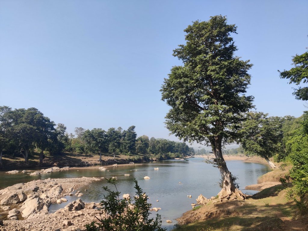
Kanhan river, a tributary of the Wainganga river, originates in the Satpura Pench corridor. Photo credit: Prachi Thatte

To understand the importance of wildlife corridors for rivers, the authors of the study overlaid topographic data and stream networks over the known wildlife corridors and their surrounding areas in Central India Highlands. They compared the forest cover, terrain ruggedness, and the number of headwater and small streams within the corridor areas as compared to the surrounding regions. They found that wildlife corridors in the region are three times more forested than surrounding areas. The significance of corridors in the region, therefore, becomes evident as forests play a pivotal role in reducing soil erosion, slowing surface runoff, and enhancing infiltration. Wildlife corridor areas were also twice as rugged as the surrounding areas. The ruggedness of an area refers to the degree of roughness or unevenness in the physical terrain of a region, typically characterized by the presence of steep slopes, cliffs, ridges, valleys, and other irregular landforms. Note that terrain ruggedness is important as it can ensure hydrological connectivity, maintain water quality, and reduce soil erosion, among other things.

The researchers further assessed the proportion of wildlife corridor areas that overlap with the catchment areas of five largest dams in the study area. These dams include Bansagar, Bargi, Gosekhurd, Tawa, and Pench Totaladah. They found that about 50% of the total area of all wildlife corridors in the region overlap with the catchment areas of these dams. This high proportion of overlap highlights the importance of maintaining these forested corridors for ensuring water quality and flow, both of which can have direct consequences for communities living downstream.

This interplay between wildlife corridors and water security underscores the need for adopting a more holistic approach to landscape management as wildlife corridors have the potential to serve multiple objectives, benefiting both wildlife and vulnerable human populations. Further, more detailed studies that identify this synergy between corridors and hydrology in different landscapes can provide additional rationale for policymakers to manage and conserve these corridors.

Some Key Terms

WatershedA watershed, also known as a drainage basin or catchment area, is a geographical area of land defined by natural topographic boundaries such as ridges, hills, and mountains. It is a region where all precipitation and surface water drains into a common outlet, such as a river, stream, lake, or ocean.
Headwater and small streamsHeadwaters refer to the source or starting point of a river or stream. They are typically found in high-elevation areas, such as mountains or hills, where water from precipitation (rain or snow) begins to flow downhill. Headwaters are often characterized by small, narrow channels and can be ephemeral, meaning they may only have water during and immediately after rain or snowmelt events, but sometimes are perennial. Despite their small size, headwaters are vital because they feed into larger rivers, and their quality can significantly influence downstream water quality.
Catchment area of a damThe catchment area of a dam, often referred to as the reservoir’s catchment or drainage basin, is the geographical area from which a dam collects water from upstream through precipitation, runoff, and tributary rivers or streams. This catchment area serves as the source of water for the reservoir created by the dam.

This article is based on the following study:
DeFries, R., Parashar, S., Neelakantan, A., Clark, B. and Krishnaswamy, J., 2023. Landscape Connectivity For Wildlife and Water: The State of the Literature. Current Landscape Ecology Reports, pp.1-10.https://doi.org/10.1007/s40823-023-00091-0
On the Move: West Africa’s Green Turtles Connect Five Nations

On the Move: West Africa’s Green Turtles Connect Five Nations

© PRASENJEET YADAV

Yashi Dwivedi

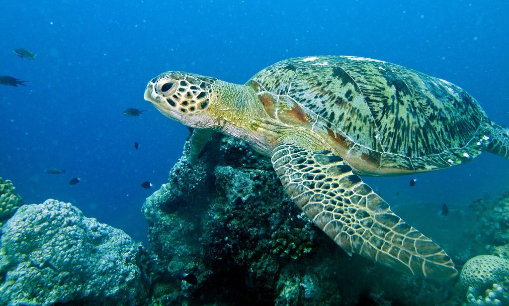
One of the largest sea turtles and a herbivore, the green turtle is widespread across the globe. Green turtles primarily feed on seagrass and algae that give their cartilage and fat the green colour. Historically, green turtles were exploited for their fat, meat, and eggs, causing global population decline. Now, many countries prohibit killing of sea turtles and collection of their eggs and have established protected areas along their coasts to protect the feeding and nesting grounds of the turtles and other marine life.

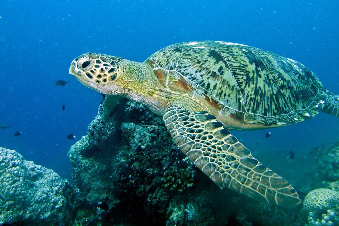
Green sea turtle. Photo credit: Bernard Dupont, via Wikimedia Commons

Similar to national parks and wildlife sanctuaries on land, Marine Protected Areas (MPAs) are nature reserves for marine biodiversity. They play a crucial role in the long-term survival of species and their habitats.

Traditionally, MPAs were not specifically planned with migration routes and connectivity in mind. However, several marine species, including green turtles migrate long distances between their feeding grounds and nesting sites. Boat strikes and entanglement in fishing gear are some of the threats that the sea turtles face while migrating long distances. Hence, assessing the connectivity across existing MPAs and identification of migration corridors are essential for ensuring the effectiveness of the protected area networks for conservation of marine species.

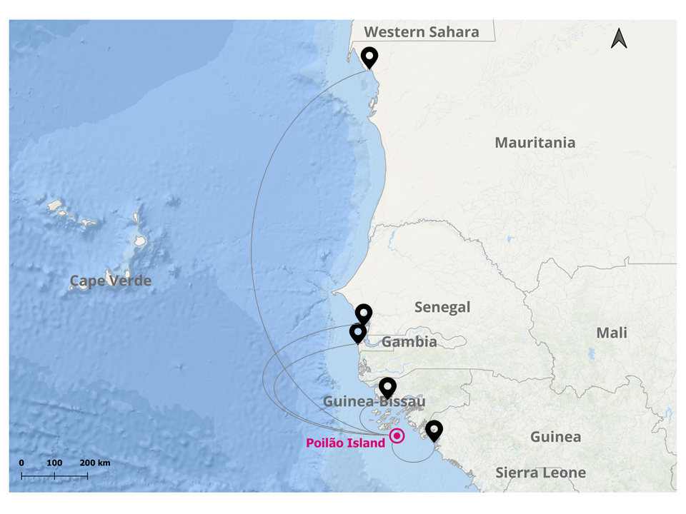
A recent study, published in the Frontiers in Marine Science journal, investigated the connectivity between marine protected areas in West Africa. This region, along the coasts of Guinea-Bissau, Senegal, the Gambia, and Mauritania, hosts rich coastal ecosystems including seagrass meadows, mangroves, and tidal flats, and is home to the largest population of green turtles in the eastern Atlantic Ocean. One of the core nesting sites for the green turtles in this region is the island of Poilão which lies in the Bijagós archipelago off the coast of Guinea-Bissau, where thousands of turtles nest every year.

During the nesting season in 2018, the researchers attached satellite tracking devices on 45 green turtles in Bijagós archipelago, Guinea-Bissau, and tracked their movements over two years. They divided the movement behavior into three distinct periods: inter-nesting (the duration between consecutive nesting events in a season – females lay eggs 3 to 6 times in a single season!), migration (the movement after nesting to foraging grounds or post-foraging to nesting grounds) , and post-nesting foraging (when they are primarily foraging and not breeding). 

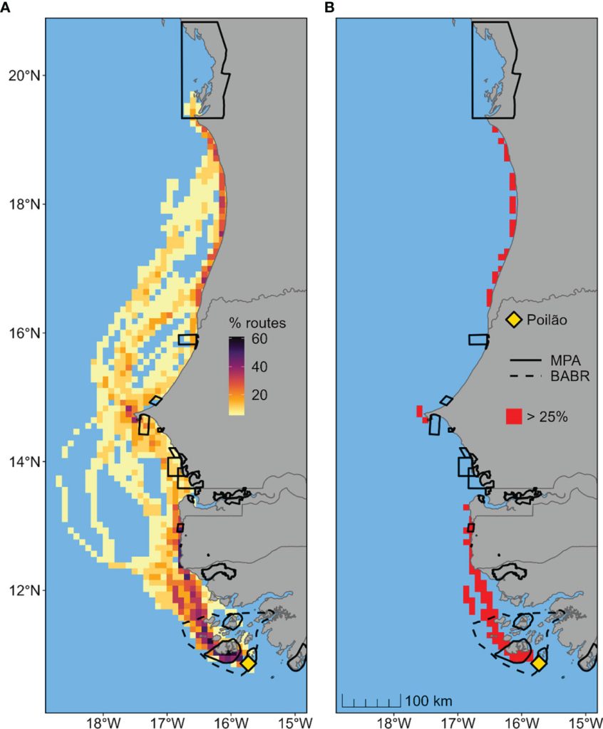
The researchers found that during the inter-nesting period, the females spent most of their time around the nesting sites and 95% of their movement was restricted to  the MPA that covered the nesting sites. Post the nesting season, some turtles migrated hundreds of kilometers away from the nesting sites, while some others remained around Guinea-Bissau throughout the year. Thirteen of the tagged turtles traveled as far as 1,000 km. north of the Bay of Arguin, in Mauritania. During migration, most turtles followed the shoreline, while some of them traveled several hundred kilometers offshore. None of the migratory turtles stopped within the archipelago for foraging during their migration. Only 21% of the areas used by migrating turtles overlapped with the MPAs in the region.

Feeding grounds of the West African green turtles

The study also investigated the movement patterns of turtles as they searched for food after nesting. Most of the turtles that migrated to Senegal, the Gambia, and Mauritania spent most of their time (78%) in the MPAs of those countries while foraging.

The study found that the migrant green turtles from Guinea-Bissau connect at least five West African nations. Overall, the nesting and foraging grounds of the turtles are well-covered by the existing protected areas. However, most areas used for migration, the migratory corridors, are not a part of the network. Since migration is seasonal, the authors of the study suggest implementing seasonal, region-specific bans on fishing practices that often cause turtle bycatch mortality.

Beyond green turtles, the findings of the study have important implications for marine spatial planning and the conservation of marine biodiversity in West Africa. While the study highlights the importance of MPAs for the conservation of marine species, it also emphasizes the need for international collaboration and information exchange for the effective conservation of migratory species. The findings of this study can be relevant and informative for policymakers, researchers, and conservationists in other regions facing similar conservation challenges.

Technical summary of the analysis methodology

For the identification of the migratory corridors, the authors used the data from the tracking devices and a movement modeling-based approach called the dynamic Brownian bridge movement model (dBBMM). This modeling approach incorporates temporal and behavioral characteristics of movement paths for estimating migratory corridors and home ranges. The movements of the 45 turtles tracked during the inter-nesting period from August to early December were used to analyze their home ranges and core-use areas using a Kernel density estimation (KDE) technique which plots the extent of the locations where the turtles were found to create a boundary. The KDE’s maps were used to identify the areas that the turtles use the most. This was combined with the dBBMM outputs showing the important pathways between protected areas.

Figure (from the paper): The migratory routes of female green turtles traveling from the nesting island (Poilão) in Guinea-Bissau to foraging areas. (A) Percentage of overlapping migration routes, defined as 95% probability areas estimated using dynamic Brownian bridge movement models. (B) Identified high-passage corridors, defined as grid cells used by at least 25% of migrating turtles. Black solid and dotted lines represent existing conservation areas in the region.

This piece is based on the following study:

A. R. Patrício, M. Beal, C. Barbosa, D. Diouck, B. J. Godley, F. M. Madeira, A. Regalla, M. S. Traoré, C. Senhoury, E. Sidina and P. Catry. (2022, March 31). Green turtles highlight connectivity across a regional marine protected area network in West Africa. Frontiers in Marine Science, Volume 9. https://doi.org/10.3389/fmars.2022.812144

Two Roads Diverged In The Wood; Which One Will The Elephant Take?

Two Roads Diverged In The Wood; Which One Will The Elephant Take?

© PRASENJEET YADAV

Advaith Jaikumar

This piece is based on the following study:

​​Vasudev, D., Fletcher, R. J., Srinivas, N., Marx, A. J., & Goswami, V. R. (2022, December 27). Mapping the connectivity–conflict interface to inform conservation. Proceedings of the National Academy of Sciences, 120(1). https://doi.org/10.1073/pnas.2211482119

Thumbnail image Credit: Ganesh Raghunathan

Background

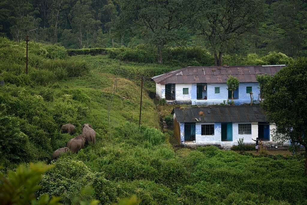
India is home to a unique situation where high densities of people share spaces with wildlife, leading to frequent encounters. It is no surprise that we often come across news articles related to these interactions. Animals need to move between habitats to find resources for basic survival needs. This movement also promotes healthier populations by fostering genetic diversity. However, dispersing animals may come into conflict with people, leading to loss of lives and livestock, and agricultural damage. This may also result in retaliatory action, posing a threat to wildlife. Coexistence has become a primary concern and a goal for people working towards conservation as well as human well-being.

In this context, how can wildlife connectivity and human-wildlife conflict be addressed simultaneously? A new paper by Divya Vasudev, Rob J Fletcher, Nishanth Srinivas, Andrew J Marx and Varun R Goswami introduces a framework that provides simultaneous perspectives of both sides of the paradox. The study, published in the Proceedings of the National Academy of Sciences (PNAS), predicts conflict hotspots and identifies location-specific strategies to minimise human-wildlife interactions and boost connectivity. The authors illustrated the framework using the endangered and wide-ranging Asian elephants in the Mysore Elephant Reserve (ER) as an example.

Asian elephants are important species in the lens of connectivity conservation and conflict mitigation. The Mysore ER is a landscape characterised by a mix of protected areas, reserve forests, and agricultural settlements. It hosts the largest population of elephants in India and is a crucial conservation area with a history of negative human-elephant interactions.

Two of the most common strategies used in the Mysore ER to deal with elephants that come into conflict while dispersing have included fencing and the removal of ‘problem’ elephants. However, while fencing may mitigate conflict, it does so at the expense of elephant dispersal through the landscape. Moreover, there have been reports of increased mortality risk of elephants trying to bypass fences. When it comes to the relocation of elephants, no example illustrates its inefficiency better than the Alur-Sakleshpur case. In 2014, the government relocated 22 elephants that were considered an isolated population. However, in less than a year, the area was recolonised by elephants. This indicates that the population was never isolated and further substantiates the need for conservation strategies tailored to the connectivity–conflict interface.

Method

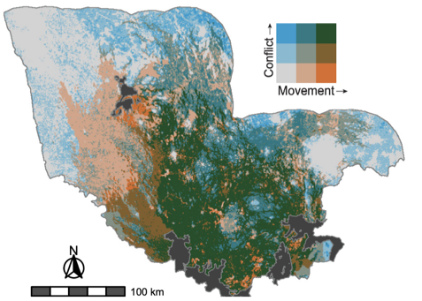
To provide a solution, the authors developed a framework that derives from random-walk theory – a concept that models animal movement step-by-step and predicts the animals’ next step based on their previous location. They extended the random-walk theory using a mathematical framework called Markov chains. The spatial absorbing Markov chain (SAMC) framework accounts for movement behaviour, mortality risk, and potential conflict for animals that migrate through a landscape. To develop their framework, the researchers collected data from three key elephant populations in the Mysore Elephant Reserve, which served as the starting points for dispersal. They also interviewed locals to gather information on elephant activity and conflict. The interview data helped validate the framework and provided insights into how elephants use the landscape and the areas where conflict is most prevalent. Landscape resistance was shown to be determined by land use and human population density, wherein elephants avoided areas with high population density.

Note: What is landscape resistance? Landscape resistance refers to the extent to which a location is difficult or easy for elephants to move through. Higher resistance values indicate that elephants are less likely to move through those areas and vice versa.

Sites with coconut and areca nut plantations had higher conditional conflict than croplands and agroforest plantations, such as coffee, since elephants tended to avoid the latter two. The study also found that the risk of conflict when elephants moved through an area was slightly higher in regions with high densities of humans.

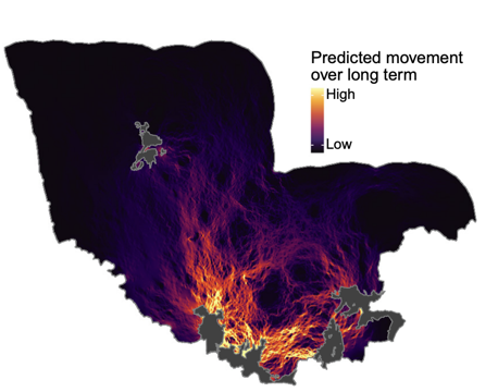
Using this data, the authors created maps of “landscape resistance” (Map 1) that show where elephants are likely to move and “conditional conflict” maps (Map 2) that show where conflict is likely to occur if elephants use a particular location. Landscape resistance and conditional conflict in the Mysore ER was found to be positively correlated, suggesting that elephants avoided moving through areas with an increased risk of conflict.

Application

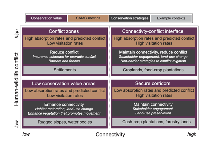
The framework addresses the paradox of connectivity and conflict mitigation and helps identify areas where strategies for addressing both can work together. It does so by simplifying the identification of relevant conservation actions in areas depending on the risk of conflict between humans and wildlife. Based on their connectivity and conflict levels, the conservation landscapes are categorised into four scenarios:

The locations of least conservation concern are those that play little or no role in connectivity and face minimal conflict. Here, conservation strategies could focus on habitat restoration, increasing woody vegetation and facilitating connectivity to encourage animal movement through these areas. Areas that allow connectivity and face minimal conflict have the highest potential for long-term conservation and human-wildlife coexistence.

The framework also distinguishes between conflict hotspots with high and low visitation rates by wildlife, and different conservation strategies are needed for each. Insurance schemes or barriers restricting animal entry may suffice for hotspots with low visitation rates since conflict here is sporadic. For hotspots with high visitation rates or in the “connectivity-conflict interface”, deeper deliberation is needed to address conflict while allowing animal movement. Redirecting animal movement to alternative corridors may also reduce negative interactions while maintaining connectivity.

Mitigating conflict and promoting connectivity does not end with identifying conservation strategies. If the concerns of the local communities are not addressed, the situation may worsen. Conservationists, governments, and scientists must engage closely with stakeholders and design long-term strategies involving community-based interventions. Context-specific conservation that allows for movement while minimising conflict is the need of the hour.

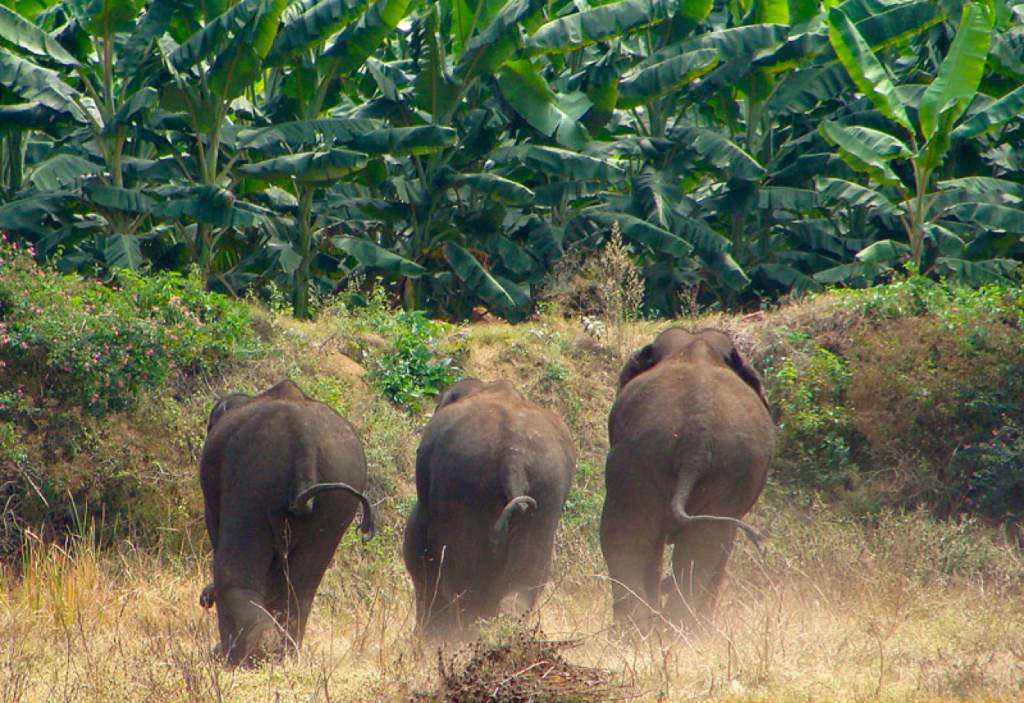
Image Credit: Nishanth Srinivasaiah

Crossing the Road Safely: How Tunnels and Fences can Reduce Herpetofauna Mortality

Crossing the Road Safely: How Tunnels and Fences can Reduce Herpetofauna Mortality

© PRASENJEET YADAV

Yashi Dwivedi

A country’s social and economic progress is aided by rapidly expanding road networks, but animals often pay a heavy price for such development. Roads passing through natural habitats hinder animal movement and increase the risk of animals being hit by vehicles while trying to cross.

While road accidents involving larger species like the tiger and elephant often get reported, there is little information available on the impact of roads on smaller animals like birds, reptiles, and amphibians that are equally rare, endangered, or threatened. These species are vulnerable to road effects because of their smaller size, relatively slower speed, and limited road avoidance behaviour, as the asphalt provides warmth on cooler evenings. This is of concern as reptiles and amphibians are among the most rapidly declining taxa globally.

Given their vulnerability, ensuring presence of proper mitigation measures is critical. Mitigation measures are often a combination of barriers (such as fences) that prevent species from crossing roads and lower the risk of mortality, and crossing structures (such as tunnels and underpasses) that provide safe passage for smaller wildlife; facilitating movement and improving wildlife connectivity. However, just incorporating such mitigation methods does not always ensure alleviation of the negative impacts of roads. In order to ensure and improve the success of mitigation measures, examining their use and effectiveness by the target species is vital.

In a recent study, scientists from Laurentian University in Ontario, Canada, investigated the impact of mitigation measures on amphibian and reptile populations in Presqu’ile Provincial Park (PPP), Ontario, Canada. PPP is home to five species of turtles and snakes, three species of salamanders, and nine species of frogs. A road runs right through this park. Although the park did not have any mitigation measures in place when established, a combination of fencing (to prevent crossings), and a couple of tunnels to facilitate crossing were put in place a few years ago. The authors wanted to understand whether mitigation promotes connectivity while lowering mortality. For that, they gathered data on roadkill and successful road crossings before, during, and after the mitigation structures were built. Data was collected using camera-traps placed on either side of the tunnels to capture the species using them. Along with cameras, the authors also tagged a subset of the species using PIT tags and installed scanners to detect the tags at one end of the tunnels.  Additionally, surveys were done three times a day on bicycles to detect road kills and crossings along the road between  2013 and 2018. Surveyors walked the road after conducting bicycle surveys so as to maximise detections.

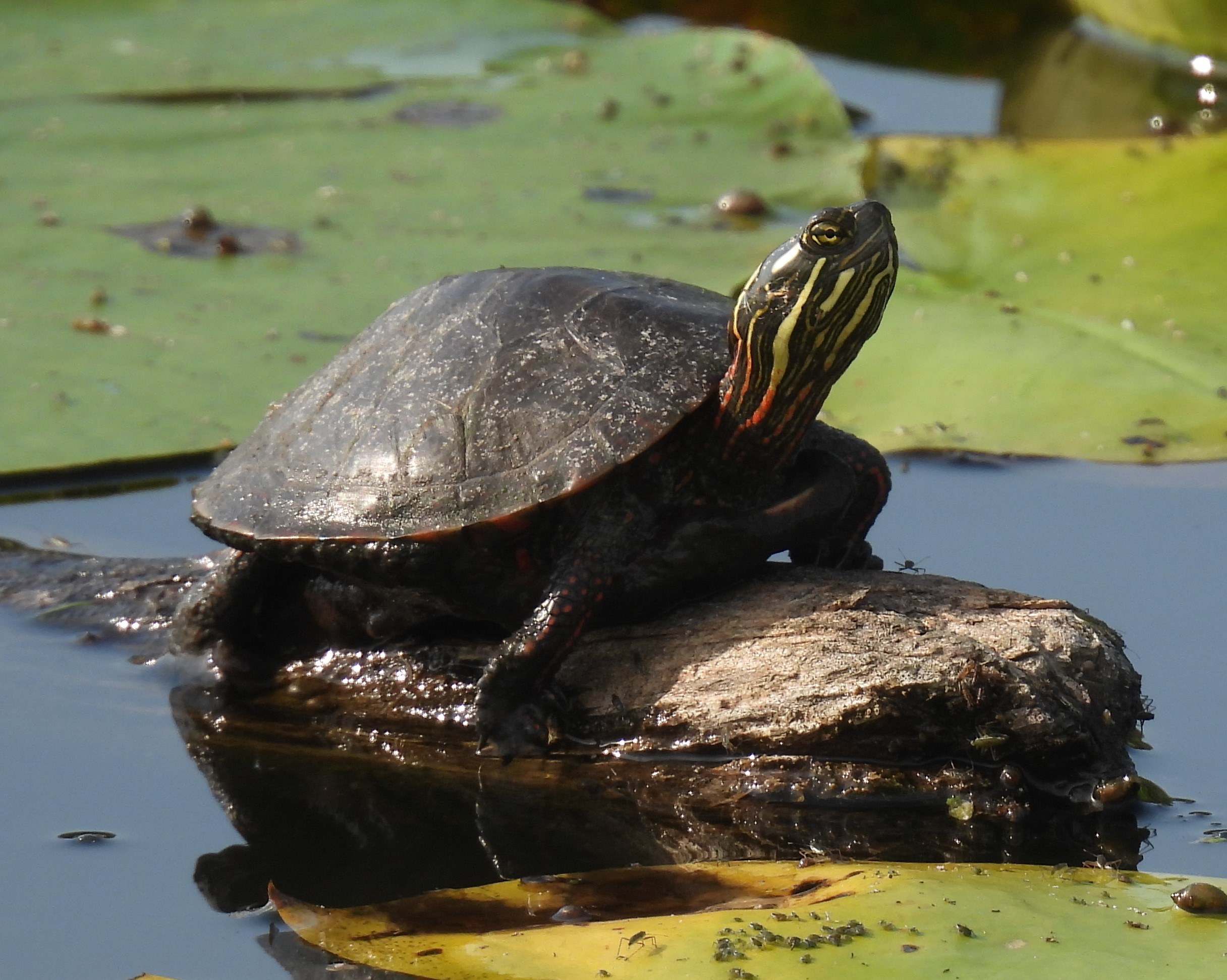
A Midland Painted Turtle in Presqu’ile Provincial Park (Image Credit: K. Osborne)

The authors found that mitigation measures significantly reduced the number of turtles and amphibians on the road. However, they did not have an impact on the number of snakes found on the roads, likely because the snakes were thin enough to  traverse through the fence. Tunnel usage by all studied species was high. Cameras recorded 72 snakes, 615 frogs, 217 salamanders, and 54 turtles using tunnels. In order to understand if the number of crossings observed was enough to maintain connectivity and prevent negative impact of the road on species populations, the authors estimated the population size of a couple of study species—the painted and snapping turtles—in the study area. They found that 5% of painted turtles and 12% of snapping turtles used the tunnels for crossing the road during the study period. Based on other studies, authors suggest this is likely to be enough to prevent road impacts. However, they acknowledge that further investigation is needed.

Mitigation measures that ensure roads do not fragment wildlife habitats are gaining global popularity and are increasingly being incorporated into infrastructure projects within India. However, most of the current mitigation measures are focused on large mammals. Structures like box and pipe culverts, routinely built for passage of water and small streams under roads or railways are often used by amphibians and reptiles. Incorporating considerations around ecology and biology of smaller species while planning placement and design of these culverts, could be a first step towards conservation of often-ignored species. Amphibians and reptiles are essential to the health of the environment and are valuable for natural biological pest control since they are significant predators of numerous insects and agricultural pests. It is important we don’t ignore the little stuff when it comes to linear infrastructure and road-impact mitigation.

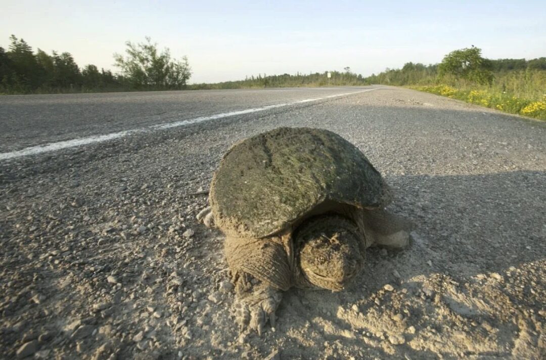
Thumbnail Image Credit: A Snapping Turtle in Ontario, Toronto Star

Using genetic information and simulations to predict the future of wild tigers in Central India

Using genetic information and simulations to predict the future of wild tigers in Central India

© Prasenjeet Yadav

Aditi Patil

Human activities haveaccelerated the decline and extinction of several animal species in recent times. The frequency with which we are losing biodiversity is higher than ever before. Habitat loss is a major threat to animals across the globe. Forests, grasslands, deserts, and other natural habitats are being replaced by human settlements, roads and industries. Most mammals have lost over half of their historical ranges over time. This has led to a decline in animal populations, placing them at a higher risk of extinction. Fragmenting large tracts of natural habitat is forcing animals to live in increasingly smaller and isolated areas. These small populations may not be able to survive on their own. If isolated animal populations can remain connected to each other through a network of structural and functional corridors that can be used by wildlife, their long-term survival can be secured. Animals will be able to migrate between populations with minimal human disturbance. Maintaining connectivity between animal populations will reduce the chances of local and global extinctions of species.

Continue reading “Using genetic information and simulations to predict the future of wild tigers in Central India”