We are back with Corridor Conversations. This time, we speak with designers who have worked on creating a series of visually compelling and creative corridor profiles. All the designers so far have been women! In our second interview of the series, we speak with Rucha Bhave who works with WCS-India
Tell us about your journey so far. How did you choose to work in this field?
I grew up fascinated by wildlife but never considered a career in this field. Design was something I was passionate about, and it wasn’t until I was doing my graduation project that I realised I could combine design and conservation. That was the first project I did in this field. I realised that design has the potential to make wildlife more accessible and appealing, and have been trying to use my skills for conservation since.
You have designed two corridor profiles so far, and are working on a third one now. Could you tell us a little bit about corridor profiles and the process of designing them?
Until I designed my first profile, I did not know much about wildlife corridors. It was an interesting experience for me, learning what wildlife corridors were and why they were important. I tried to use that experience to identify what might make it easier for other people to understand corridors.
Before designing a profile, I spend some time studying the corridor. I speak to experts to identify certain aspects of a corridor that the reader needs to understand at first glance and then see if that information has the potential to become an interesting visual.
Is communicating about corridors different from other types of conservation communication?
A corridor profile is a comprehensive compilation of information about the corridor, its characteristics, and the challenges it faces. The purpose of visuals in a profile is to give the reader a sense of the corridor without having to visit the landscape. Communicating about a corridor is about trying to capture its essence in a few illustrations. The motive of design remains similar to other types of conservation communication, which is to make information more engaging through visuals.
Which is your favourite illustration from the profiles you have designed so far and why?
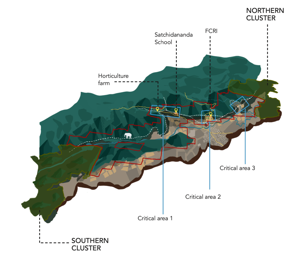
When I was designing my first corridor profile for the Kallar corridor, I had the wonderful opportunity to visit the corridor and understand the landscape. It made a big difference in the way I executed the design for this profile. It resulted in one of my favourite illustrations I have made for the profiles, a map showing the different terrains in the Kallar corridor, the threats the corridor faces and how elephants travel through this space. I think this visual shows the potential illustrations have as a unique medium to convey complex information.
We are back with Corridor Conversations. This time, we speak with designers who have worked on creating a series of visually compelling and creative corridor profiles. All the designers so far have been women!
To kick things off on International Women’s Day 2024, we hear from Raiva Singh, who works with WWF-India, on her journey and work.
Tell us about your journey so far. How did you choose to work in this field?
Nature has always fascinated me since my childhood. It is like a magical house that gives me a sense of wonder about how a single cell can multiply and develop into a full form of life. The tapestry of interwoven colour and life teaches us a lot if we look closely and connect with it.
My mother, an artist, introduced me to colours and various forms of art. She taught me that every colour we use today is found in nature, and every artist takes inspiration from it. She encouraged me to connect with nature when I feel like I have nothing to take inspiration from, as it can awe me with its magical powers and inspire me to move forward.
On the other hand, my father, a botanist, taught me the scientific importance of various flora and fauna. He took me and my brother out to various landscapes and taught us the scientific names of different plants, their use in the ecosystem, and how they provide to us humans.
As I grew up, I developed my own art style, which included nature in everything and inspired me to work in the conservation sector.
Could you tell us about corridor profiles and the process of designing them?
Designing a corridor profile is a valuable learning experience for me. Before starting the design process, I make sure to visit the corridor or study it in-depth along with the people who live and work in the area. This allows me to gain unique insights into the corridor, understand its differences, and identify the challenges it poses.
During this period, I also have the opportunity to learn about a variety of behaviours and interesting facts about the local wildlife, as well as the co-existence stories of humans and animals. I also gain an understanding of the major reasons for conflicts between them and the steps that we are taking to reduce them.
This information is extremely useful when it comes to the final outcome of the design process. It helps me incorporate these factors creatively so that people outside the conservation sector can also become interested in learning more about the corridor and help in conservation.
Is communicating about corridors different from other types of conservation communication?
Yes, not many people are aware of corridors and why it is crucial to conserve them. Though I am not from a conservation background, I learned about it when I joined WWF India. It is fascinating to learn about animal movement and their incredible tendency to adapt. Corridors are a perfect example of how animals can survive and adjust to urban expansion caused by humans. However, the question remains – for how long can they continue to do so?
Which is your favourite illustration from the profiles you’ve designed?
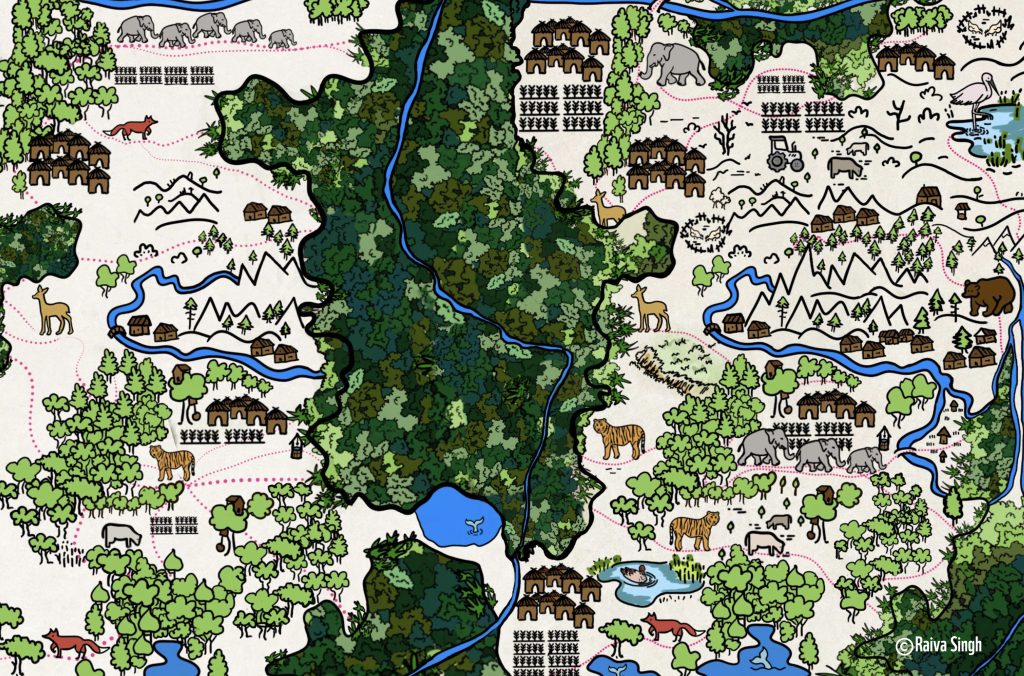
I cannot choose a single illustration as each one represents the uniqueness of different corridors. However, if I had to pick one, I would choose the first illustration I designed for the Coalition for Wildlife Corridors. It shows forest patches, corridors, and the incredible ability of animals to navigate their way through urban mazes. It serves as a learning map for people who do not come from a conservation background, helping them to better understand what corridors are.
In the pursuit of conserving its diverse and endangered wildlife, India has been formulating long-term National Wildlife Action Plans (NWAPs) since 1983. These have emerged as critical advisory plans to guide different departments and committees in strengthening their efforts to protect India’s wildlife. In this article, we explore the current status and key highlights regarding corridors within the framework of the latest plan. This article is the second segment in our series exploring the integration of wildlife corridors into the NWAP. For a concise overview of how NWAPs have evolved to incorporate wildlife corridors, please refer to our initial article, available here.
The third version of the National Wildlife Action Plan (NWAP), covering the period from 2017 to 2031, builds upon the experience of the preceding two plans and the concurrent advancements in our understanding of landscape ecology over the decades. Unlike the first two versions, it adopts a landscape-level approach to conservation and suggests several actions and projects for strengthening and promoting the integrated management of wildlife and their habitats, including wildlife corridors. It calls for strategies for delineating landscapes, managing wildlife corridors, and involving stakeholders to maintain ecological connectivity.
Delineation of Landscapes
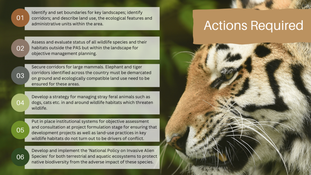
The plan suggests that the boundaries for key landscapes must be identified and land use, ecological features, and administrative units within the area must be defined. These must be used to create detailed land-use and land development maps of the identified landscapes, including not only reserve and revenue forests but also corridors that connect habitats within the landscape, especially those that connect protected areas with forests outside. Further, corridors used by large mammals such as tigers and elephants, which have been identified previously, must be “demarcated on ground” as the first step to ensure ecologically compatible land use across the corridors.
Key actions outlined in the third NWAP for ‘landscape-level wildlife conservation’. The plan identifies 17 objectives, each with specific actions and priority projects. Wildlife corridors feature prominently across multiple objectives, highlighting their significance in conservation efforts.
Management Plan for Wildlife Corridors
The NWAP provides specific guidelines and measures to secure wildlife corridors by improving corridor management, ensuring habitat restoration along corridors, minimizing human disturbances, promoting community participation, and incorporating landscape planning that considers the needs of wildlife movement. Foremost, the NWAP recommended that central guidelines be issued for preparing management plans for wildlife corridors and regulating land-use change in the identified corridors. These guidelines can be used by state forest departments to develop corridor management plans to prevent ecologically unsustainable activities in the area. The plan notes that wildlife areas in India are “largely interspersed with human habitations, power and irrigation related infrastructures, industrial estates and a variety of human activities.” Consequently, it explicitly states that corridor management plans should be prepared after active participation of different stakeholders. To ensure effective translation of plans into actions on ground, NWAP also suggests that the wildlife corridor plans must be integrated with the working plans or management plans of the state forest departments.
The status of all wildlife species and their habitats outside the protected areas but within the identified landscape must be assessed for objective management planning. Endemic and endangered species in need of conservation should be targeted for special recovery projects. In addition, the third NWAP identifies that a periodic review of the status of protected areas and corridors must be conducted every 10 years.
Integrating NWAP with Other Sectoral Programs
Given that protected areas are embedded in and several corridors are a complex mosaic of land-use that is often human-dominated, the participation and cooperation of different government sectors is imperative for landscape-scale conservation to succeed. The third plan identifies the need for an appropriate mechanism for ensuring effective coordination among various ministries, departments, and institutions. It also suggests that the idea of wildlife conservation should be integrated in the strategies, plans, and programmes of different sectors, including agriculture, fisheries, infrastructure, mining, petroleum, and tourism. For example, the plan suggests that the Ministry of Road Transport & Highways, Ministry of Railways, Ministry of Mines, Ministry of Coal, and Ministry of Petroleum & Natural Gas must address concerns about corridor connectivity during the planning stages of their projects. Consequently, they should adopt appropriate designs and technological solutions to mitigate the expected problems.
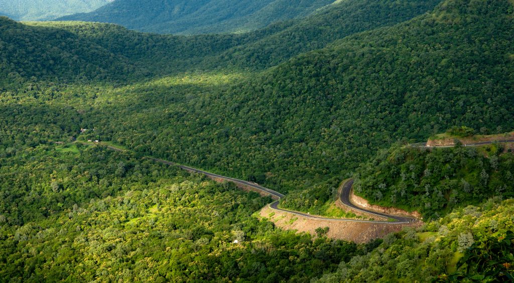
A road cutting through a forested area. The third NWAP emphasizes the importance of considering corridor connectivity in the early planning phases of infrastructure projects through corridor areas. Image by wirestock on Freepik.
Education, Training, and Awareness of Managers and Forest Staff
In addition to direct management actions, the third NWAP also highlights the importance of education and training in long-term management of corridors. The existing mechanisms of recruitment, training, and career development of wildlife managers working in protected areas or territorial forests must be reviewed and revised. The frontline field staff must be equipped to protect wildlife by organizing training workshops, improving forensic support, and deploying modern technology for surveillance. For example, camera traps can be deployed in important corridors to protect the transient wildlife population. Moreover, the syllabi of various training and academic programmes, such as those offered by Wildlife Institute of India (Advanced Post Graduate Diploma, Certificate and Master of Science), must cover the full range of wildlife management, including management of corridors.
Conservation Under Changing Climate
What makes the third version of the NWAP unique is that this is the first time India has recognised the concerns relating to climate change impact on wildlife and stressed on integrating actions that need to be taken for the mitigation and adaptation of the impacts. For example, it calls for initiating a programme for assisted migration of wildlife, especially in highly fragmented landscapes and coastal areas where the impact of climate change may be more pronounced.
Tourism and Eco-development Projects Outside Protected Areas
The plan suggests that tourism potential should be explored outside protected areas, especially forested areas, safari parks, etc. As many of the forested lands outside protected areas in India are part of corridors, this suggestion can be indirectly associated with corridors. The revenue from tourism can be funneled back into wildlife management and community development. Previous NWAPs also suggested the use of eco-development in the management of protected areas. Eco-development is a multi-stakeholder and multi-disciplinary strategy that associates conservation value of a protected area with the livelihoods of surrounding communities. Per the third NWAP, eco-development projects should not be confined to tiger reserves, national parks, and wildlife sanctuaries but should be extended to other areas, including conservation and community reserves, recognized wildlife corridors, important wetlands, and elephant reserves. Notably, the plan also suggests that a feasibility study be conducted to assess the potential involvement of the private sector in conservation programmes within and outside protected areas.
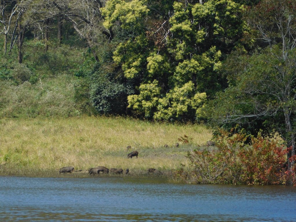
Wild pigs on the banks of Periyar river in Periyar Tiger Reserve, Kerala. This tiger reserve became a celebrated model for eco-development and participatory management of biodiverse areas in the country. Eco-development projects were adopted during the earlier NWAPs but the third version suggests that these projects should not be confined to protected areas but also extended to other important conservation areas, including wildlife corridors. Image by: Shyamlal Chandra Ghosh (Wikimedia Commons)
Conclusion
The third NWAP recognizes the need to protect wildlife corridors and connect habitats at a landscape-level. Overall, the latest NWAP has expanded its scope to address contemporary challenges to wildlife conservation. By incorporating holistic strategies, involving various stakeholders, and recognizing the impact of changing climate, it strives to ensure long-term sustenance of wildlife. However, the future of wildlife will depend on how well this plan is implemented and how effectively it adapts to evolving environmental and socio-economic dynamics. Its success also relies on the commitment of implementing agencies, conservation organizations, and local communities to work collaboratively to safeguard wildlife beyond the protected areas.
In the pursuit of conserving its diverse and endangered wildlife, India has been formulating long-term National Wildlife Action Plans (NWAPs) since 1983. These have emerged as critical advisory plans to guide different departments and committees in strengthening their efforts to protect India’s wildlife. In this article, we briefly discuss the evolution of the focus of the first two NWAPs to include wildlife corridors.
A Brief History of the National Wildlife Action Plan
The enactment of the Wildlife (Protection) Act in 1972—for the first time—provided a legal framework for conservation in India, which was followed by the Forest (Conservation) Act, 1980. However, it was soon realized that a long-term strategy and action programme was warranted for effective protection, conservation, and management of wildlife across the country. Inspired by the World Conservation Strategy and the Bali Action Plan of IUCN, the Indian Board of Wildlife (the apex advisory body for providing guidance to both the Central and State Governments on wildlife conservation matters, which was later replaced by National Board of Wildlife) launched the first National Wildlife Action Plan (NWAP) in 1983. It has since undergone two revisions to keep up with the changing landscape of wildlife conservation in India. Though not a legally enforceable document, it acts as a guideline for policymakers, advocating for specific projects and actions for effective wildlife conservation in the country.
Evolution of the National Wildlife Action Plan: The First Two Iterations
The first NWAP was effective from 1983 to 2002 and recommended a number of measures to strengthen the network of protected areas and enhance their management effectiveness. In the decades since the first plan came into effect, the number of protected areas increased substantially, from 257 in 1983 to 998 in 2023. The plan also focused on rehabilitation and captive breeding programmes of endangered and threatened species and highlighted—for the first time—the importance of collaboration between voluntary bodies and non-government organizations. This plan, however, did not focus on landscape-level conservation measures, which is understandable as the concept of landscape connectivity gained popularity in the early 1990s, almost a decade after the first plan was formulated. Nonetheless, this concept was reflected in the second iteration of NWAP, which was adopted in 2002.
The second NWAP (2002–2016) identified that national action plans cannot be successful in isolation, and there is a need to look beyond national parks and wildlife sanctuaries for efficient wildlife conservation. Acknowledging the fact that areas outside the protected area network often form vital ecological corridor links, the plan highlighted that corridors must be identified and protected to prevent further isolation of habitats to ensure long-term sustenance of biodiversity. It explicitly stated that new roads must be constructed in a manner that they by-pass all national parks and sanctuaries and avoid wildlife corridors or employ mitigative measures (such as restricting night traffic), if required. Each state/UT was recommended to identify and prioritize degraded habitats and corridors outside protected areas. These areas could be declared as ecologically fragileunder the Environment (Protection) Act, 1986, thereby prohibiting or regulating certain activities in corridor areas. The plan also suggested that essential land and water use policies should be formulated for protecting the ecologically fragile habitats. Notably, this plan introduced two new legal categories of protected areas, namely Conservation Reserves and Community Reserves. Over the years, several conservation reserves have been notified in areas overlapping with wildlife corridors.
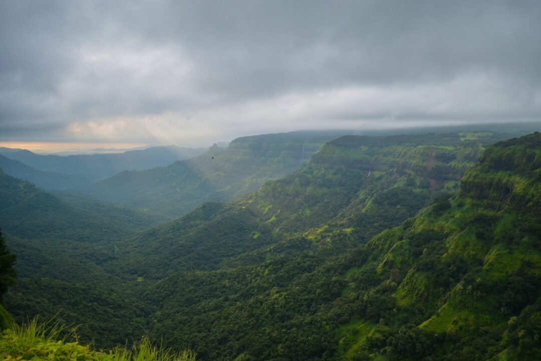
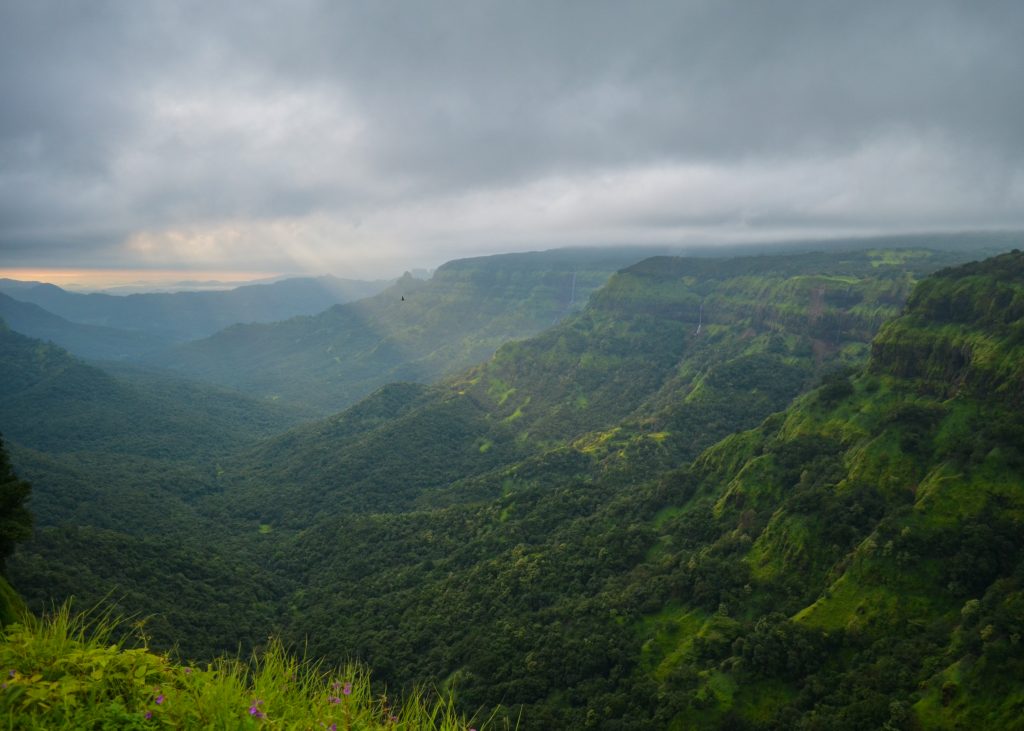
Panoramic view of Amboli Ghat, Maharashtra. Dodamarg-Amboli Conservation Reserve was notified in 2021 and lies within the Sahyadri-Konkan Corridor, which connects Sahyadri Tiger Reserve in Maharashtra with protected areas of Goa and Karnataka. Image by Yash Hegde (Wikimedia Commons)
During the period when the second NWAP was in effect, several wildlife corridors were identified by different reports. National Tiger Conservation Authority and Wildlife Institute of India identified 32 major tiger corridors, whereas Wildlife Trust of India identified 101 elephant corridors across the country. In addition to these, researchers identified several other corridors, such as Mt Abu–Jessore Corridor in Gujarat and Bandhavgarh–Nauradehi Corridor in Madhya Pradesh.
The third NWAP, adopted in 2017, emphasized a landscape-level approach to conservation, focusing on wildlife corridors and integrated habitat management. The plan outlines guidelines for corridor management, habitat restoration, and community involvement. It also advocates for the growth of tourism and eco-development projects beyond protected areas.
To delve deeper into how wildlife corridors are integrated into the latest NWAP, check our second article in this series. Find the article here.
Since it first gained popularity in the early 1990s, the term “landscape connectivity” has gradually made its way into the lexicon of wildlife conservationists and policymakers alike. In simple terms, landscape connectivity measures how well different areas in a landscape are connected to each other. It has mostly been studied for its role in facilitating the movement of iconic animals such as grizzly bears, jaguars, tigers, and elephants, as they move around in search of mates, food, and other resources.The passageways—or areas with high landscape connectivity—used by animals are more popularly known as “wildlife corridors”. Some famous corridors include the trans-boundary Yellowstone–Yukon Corridor that traverses across the United States and Canada, Serengeti-Mara Corridor that spans across Tanzania and Kenya, and the Kanha–Pench Corridor in Central India.
However, wildlife corridors are not just highways for animals. These corridors influence various biotic and abiotic flows between two or more habitats, affecting everything from seed dispersal to water movement and even the spread of wildfires and diseases in some cases. These flows on the land surface, below ground and through the atmosphere, can have consequences that ripple beyond the wilderness and contribute to human well-being and in some cases hazards as well. Take, for instance, their potential role in safeguarding the water resources in a region. As wildlife corridors often include large swathes of natural or semi-natural habitats (such as forests, grasslands, and agriculture-forest mosaic), they can play a crucial role in safeguarding the water resources in watersheds, shielding them from sedimentation, contamination, and flood risks and also contribute to rainfall in neighboring regions through recycling of transpired water from vegetation.
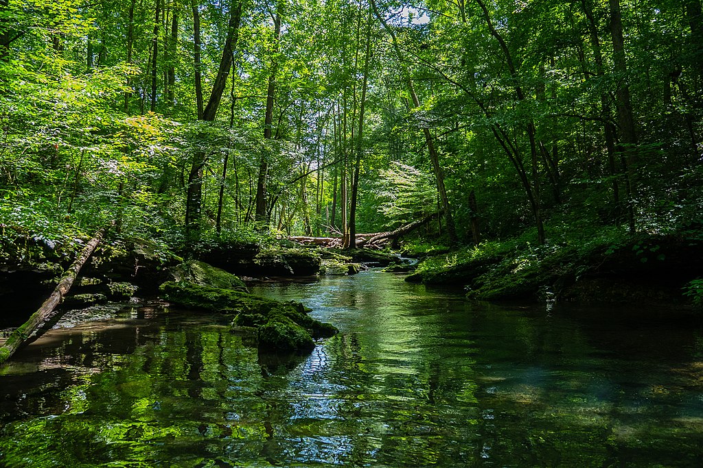
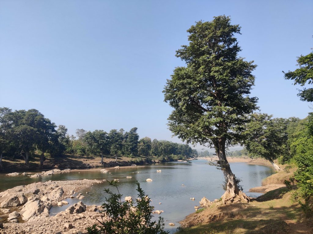
River in a forest. Photo credit: Rakielle via Wikimedia Commons
Given this potential association between wildlife corridors and water resources, it is only fitting to inquire whether this relationship has received comprehensive attention in the existing body of literature.
A recent study by scientists from India and the United States reviewed the degree to which the hydrologic function of wildlife corridors has been assessed in literature and conservation practice. The authors assessed the literature on connectivity using a bibliometric analysis, which is a quantitative research method used to evaluate and analyze scholarly literature to identify the trends in studies. They analyzed 3600+ research papers published between 1990 and 2023 and reported that only limited studies on landscape connectivity have addressed hydrology (with only 15 studies in 2022). About 50% of the publications that address wildlife or biodiversity along with hydrology or watersheds were published after 2015, highlighting the early stage of this thematic research area. Further studies are warranted to reveal how landscape connectivity for wildlife corridors can affect watershed protection in different landscapes.
Central Indian Highlands: A Case in Point
To underpin the synergy between wildlife corridors and hydrology, the authors also included a case study of the Central Indian Highlands. These highlands comprise a series of different hill ranges and plateaus, and are a part of the larger Deccan Plateau, spanning across Madhya Pradesh and parts of Maharashtra and Chattisgarh. They boast a diverse landscape, featuring dense forests, rolling hills, deep valleys, and numerous rivers and streams. This region also supports a rich biodiversity and has been a focal point for tiger conservation in India and houses several famous protected areas such as Kanha National Park and Pench, Melghat, and Satpura tiger reserves, among others.
Notably, the headwaters for several major rivers, including the Narmada, Tapti, Wainganga, and Pench rivers lie in these highlands. These rivers are vital for providing water resources to downstream areas, which have been home to indigenous communities and tribal populations for centuries. However, a previous study has reported that about 74% of the area of the Central Indian Highlands experienced water stress for a minimum of four months every year between 2004 and 2012. Water security in this region—as with several areas in India—has been recognized as a critical issue by policymakers, civil society organizations, academics, and researchers.
Kanhan river, a tributary of the Wainganga river, originates in the Satpura Pench corridor. Photo credit: Prachi Thatte
To understand the importance of wildlife corridors for rivers, the authors of the study overlaid topographic data and stream networks over the known wildlife corridors and their surrounding areas in Central India Highlands. They compared the forest cover, terrain ruggedness, and the number of headwater and small streams within the corridor areas as compared to the surrounding regions. They found that wildlife corridors in the region are three times more forested than surrounding areas. The significance of corridors in the region, therefore, becomes evident as forests play a pivotal role in reducing soil erosion, slowing surface runoff, and enhancing infiltration. Wildlife corridor areas were also twice as rugged as the surrounding areas. The ruggedness of an area refers to the degree of roughness or unevenness in the physical terrain of a region, typically characterized by the presence of steep slopes, cliffs, ridges, valleys, and other irregular landforms. Note that terrain ruggedness is important as it can ensure hydrological connectivity, maintain water quality, and reduce soil erosion, among other things.
The researchers further assessed the proportion of wildlife corridor areas that overlap with the catchment areas of five largest dams in the study area. These dams include Bansagar, Bargi, Gosekhurd, Tawa, and Pench Totaladah. They found that about 50% of the total area of all wildlife corridors in the region overlap with the catchment areas of these dams. This high proportion of overlap highlights the importance of maintaining these forested corridors for ensuring water quality and flow, both of which can have direct consequences for communities living downstream.
This interplay between wildlife corridors and water security underscores the need for adopting a more holistic approach to landscape management as wildlife corridors have the potential to serve multiple objectives, benefiting both wildlife and vulnerable human populations. Further, more detailed studies that identify this synergy between corridors and hydrology in different landscapes can provide additional rationale for policymakers to manage and conserve these corridors.
Some Key Terms
Watershed
A watershed, also known as a drainage basin or catchment area, is a geographical area of land defined by natural topographic boundaries such as ridges, hills, and mountains. It is a region where all precipitation and surface water drains into a common outlet, such as a river, stream, lake, or ocean.
Headwater and small streams
Headwaters refer to the source or starting point of a river or stream. They are typically found in high-elevation areas, such as mountains or hills, where water from precipitation (rain or snow) begins to flow downhill. Headwaters are often characterized by small, narrow channels and can be ephemeral, meaning they may only have water during and immediately after rain or snowmelt events, but sometimes are perennial. Despite their small size, headwaters are vital because they feed into larger rivers, and their quality can significantly influence downstream water quality.
Catchment area of a dam
The catchment area of a dam, often referred to as the reservoir’s catchment or drainage basin, is the geographical area from which a dam collects water from upstream through precipitation, runoff, and tributary rivers or streams. This catchment area serves as the source of water for the reservoir created by the dam.
This article is based on the following study: DeFries, R., Parashar, S., Neelakantan, A., Clark, B. and Krishnaswamy, J., 2023. Landscape Connectivity For Wildlife and Water: The State of the Literature. Current Landscape Ecology Reports, pp.1-10.https://doi.org/10.1007/s40823-023-00091-0
Picture this – crack of dawn on a quiet summer morning in April. One treks up to Guru Shikhar, the highest peak in the Aravallis, passing hardwood trees of teak, bael, and amla, and wild orchids. A quick time lapse – as one peers across the crevasse of blue-green-brown abundance, one can see the way land use has changed over the years with agriculture rising steadily in place of scrub and barren, rocky brown land. Instances of human-animal interactions are on the rise in the region, with species like the vulnerable sloth bears seeking space for food and movement, as the forests diminish and the human footprint increases. Various studies reflect that the issues of habitat degradation, fragmentation and lack of protection of corridors that facilitate movement are impacting the sloth bear populations of the region.
Conservationists call for a holistic solution to tackle the issues faced by the species, a strategy based on landscape–scale conservation values.
Mount Abu–Jessore Ecoregion
In Sirohi district of Rajasthan, nestled in the ancient folds of India’s oldest mountain range are the forests of Mount Abu Wildlife Sanctuary, which was declared a protected area in the year 1980 and was recently notified as an Eco-Sensitive Zone. The 288 km2 ecoregion is home to a variety of large fauna like Indian leopard (Panthera pardus fusca), striped hyena (Hyaena hyaena), jungle cat (Felis chaus), chinkara (Gazella bennettii) and particularly – the sloth bear (Melursus ursinus). The solitary, shaggy-coated bear, native to the Indian subcontinent is a native resident here. The mid-sized bear’s choice of meal – ants, termites and fleshy fruits – can be found here in plenty. This is incidentally the only forest in the region where one can find a variety of wild orchids. The region is plentiful in floral biodiversity with various species of sub tropical thorn shrubs thriving here, along with rare varieties of wild roses and ferns.
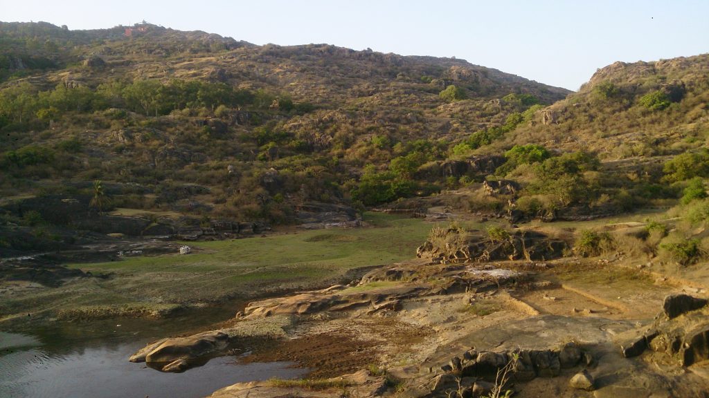
Sloth bear habitat in the Mount Abu-Jessore landscape. Photo by: Nishith Dharaiya
Upon driving approximately 60 km. southwest from the centre of the Mount Abu town in the Aravallis, one reaches the Jessore Sloth Bear Sanctuary in Banaskantha District, Gujarat, which was notified as a protected area dedicated to sloth bear conservation in 1978. Namesake to the spectacular Mount Jessore, a picture perfect backdrop, the Sanctuary is reported to support one of the highest sloth bear densities in India (Sukhadiya et al. 2013). Other fauna reported in the sanctuary are the leopard , sambar (Rusa unicolor), wild boar (Sus scrofa), Indian crested porcupine (Hystrix indica), etc. Also supporting a large diversity of birds and reptiles, the area has a great ecological significance as it acts as a buffer between the arid desert and the dry deciduous forest.
Corridor
An approximately 40 km2 stretch of land connects Mount Abu to Jessore and acts as a corridor for wildlife movement between the areas. Set in the semi-arid – dry deciduous region of Rajasthan and Gujarat, the corridor gets its much needed respite through the small streams, rivulets originating and meeting the West Banas River. Deora Dam reservoir is one of the larger water sources of the region. It has been reported that ~68% of the corridor land is farmland with ~30% classified as Open Forest and Scrub (Vyas, 2020). Most of the forest areas in and around this corridor act as catchment for the West Banas and assist in replenishing the ground water. Over time, this corridor has become increasingly instrumental for securing unhindered movement of sloth bears.
Significance
Since both Mount Abu and Jessore support high density of sloth bear populations in the Aravallis landscape, maintaining connectivity between these two ecoregions is crucial to ensure viability of their populations in the area. Not just for sloth bears, Mount Abu –Jessore corridor also aids the movement of leopards and hyenas, among other species, and helps these species thrive in the region. The areas demarcate the western limit of sloth bear’s range in the Aravallis.
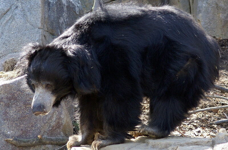
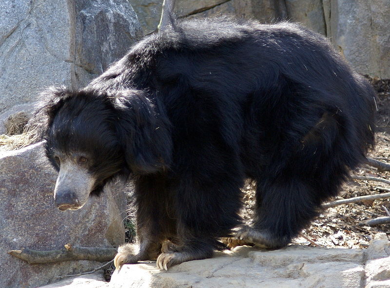
The shaggy-haired sloth bear. Photo by- Nishith Dharaiya
Shrinking Land and Lunches
As per a recent notification (2020) declaring an Eco-Sensitive Zone (ESZ) around Mount Abu Wildlife Sanctuary, most of the corridor area now comes under regulation of the Environment Protection Act (1986). ESZ’s are meant to act as ‘shock absorbers’ for the protected areas, preventing encroachment and restricting environmentally detrimental activities like mining, construction etc.
Data available on land use in the corridor suggests that there have been substantial changes in the land use pattern. Over the past 30 years,area under agriculture has increased considerably, largely owing to conversion of barren land and forests into crop fields (Vyas, 2020). This has resulted in fragmentation of forest and scrubland which provides habitat, food, and cover to various species. It is essential to protect the remaining forest and scrubland patches within the corridor from any further degradation, and restore habitat connections where needed, as sloth bears have strong habitat associations (Ramesh et al., 2012; Das et al., 2014; Puri et al., 2015 ) and a fragmented corridor could impact them dearly.
Way Forward
Sloth bear populations need to stay geographically connected to maintain healthy genetic diversity and prevent inbreeding. However, protecting and maintaining wildlife corridors in India is an epic challenge, since they don’t fall within the ambit of legal protected area category. Despite being so crucial to maintaining structural and functional integrity of an ecosystem, wildlife corridors are often given less importance in governance. Any reform must first begin here, at the foundational level of recognising these ecoregions for their immense service of ensuring habitat connectivity. While some rules and guidelines under the National Tiger Conservation Authority can be favourably invoked to provide protection to tiger and elephant corridors, more needs to be done. In a sea of human settlements, agriculture, and linear infrastructure, without wildlife corridors, forests will become isolated pockets of biodiversity, severely affecting the long-term viability of populations of many species. An effective policy with the values of sustainability and conservation-led development will improve corridor management, thereby ensuring the populations of our shaggy-haired bears are sustained.
Sukhadiya,D., J.U. Joshi, and N. Dhairiya. 2013. Feeding Ecology and Habitat Use of Sloth Bear (Melursus ursinus) in Jassore Wildlife Sanctuary, Gujarat, India. Indian J. Ecol. (2013) 40(1): 14-18
Ramesh, T., R. Kalle, K. Sankar, and Q. Qureshi. 2012. Factors affecting habitat patch use by sloth bears in Mudumalai Tiger Reserve, Western Ghats, India. Ursus 23(1), 78-85, (1 May 2012). https://doi.org/10.2192/URSUS-D-11-00006.1
Vyas, S., 2020. Assessment of change in land use land cover in Western Aravallis with respect to sloth bear habitat (M. Phil. Thesis). Hemchandracharya North Gujarat University, Patan.
Das, S., Dutta, S., Sen, S., S., J. A., Babu, S., Kumara, H. N., & Singh, M. (2014). Identifying regions for conservation of sloth bears through occupancy modelling in north-eastern Karnataka, India. Ursus, 25(2), 111–120. http://www.jstor.org/stable/24643778
Puri, M., Srivathsa, A., Karanth, K.K., Kumar, N.S. and Karanth, K.U. (2015), Multiscale distribution models for conserving widespread species: the case of sloth bear Melursus ursinus in India. Diversity Distrib., 21: 1087-1100. https://doi.org/10.1111/ddi.12335
Dharaiya, N., 2009. Evaluating habitat & human–bear conflicts in North Gujarat, India, to seek solutions for human–bear coexistence (Research Project Report). North Gujarat. Available at: https://ruffordorg.s3.amazonaws.com/media/project_reports/14.11.07%20 Detailed%20Final%20Report.pdf
The Madhya Pradesh Forest Department and the Coalition for Wildlife Corridors organized the first ‘Corridor Conservation Planning Workshop’ for Satpura–Pench and Satpura–Melghat corridors in Pachmarhi on June 6 and 7, 2023. The workshop brought together 70+ representatives from different domains—forest department officials, district administration representatives, tribal welfare department officials and conservationists, among others—to discuss and deliberate about various aspects of corridor conservation, including their current status, threats, and management. Here, we discuss why corridor conservation planning is a complex task that requires timely and effective collaboration.
What is a wildlife corridor?
Wildlife corridors are generally understood to be narrow strips of natural habitat that connect two or more habitat patches, which were historically contiguous, and serve as conduits for animal movement between these patches. In reality, several corridors in India are not linear homogenous strips of habitat but a mosaic of fragmented forests and other land-use types, which leopard, tiger, elephant, dhole, and other wildlife species use to move between habitats. In the present times, however, these multi-use corridors are being rapidly transformed and are often at risk of further land use change, habitat loss, and fragmentation. It is crucial to conserve these corridors to maintain viable wildlife populations in the future.
To ensure that animals can move freely between habitats, effective conservation planning is where it all starts. Having corridor conservation plans that balance wildlife needs, well-being of the communities living in the corridor, and economic goals of the region is the need of the hour.
Whose corridors are these anyway? Many uses, many users
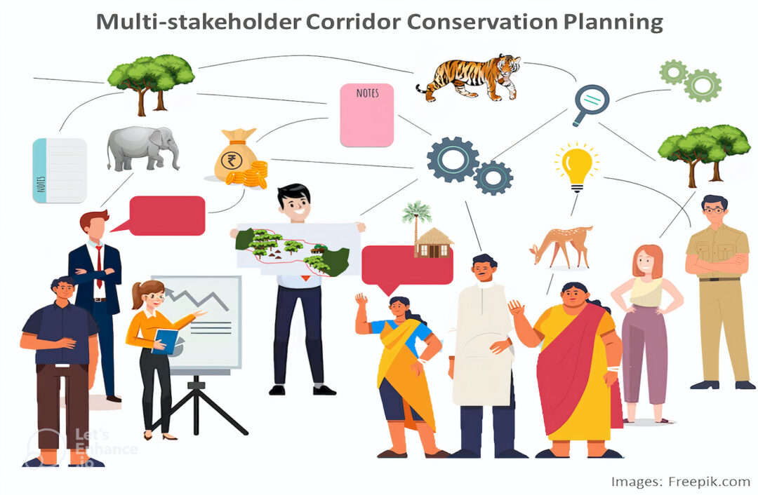
As we wrestle with the question of identifying the most efficient strategy of corridor conversation and management, it is imperative to recognize the role of different stakeholders. This is essential because many corridors in India are spread across several hundred kilometers, which brings forth a unique challenge—the presence of diverse land use types, jurisdictions, and stakeholders. These corridors often have forested areas, hundreds of villages, farmlands, densely populated cities, rapidly growing towns, and industries within their boundaries. Animal movement in these corridors is often obstructed by intersecting linear infrastructure such as highways, railways, and power transmission lines. Moreover, some corridors also overlap with the coal-bearing belts or ore reserves of the country.
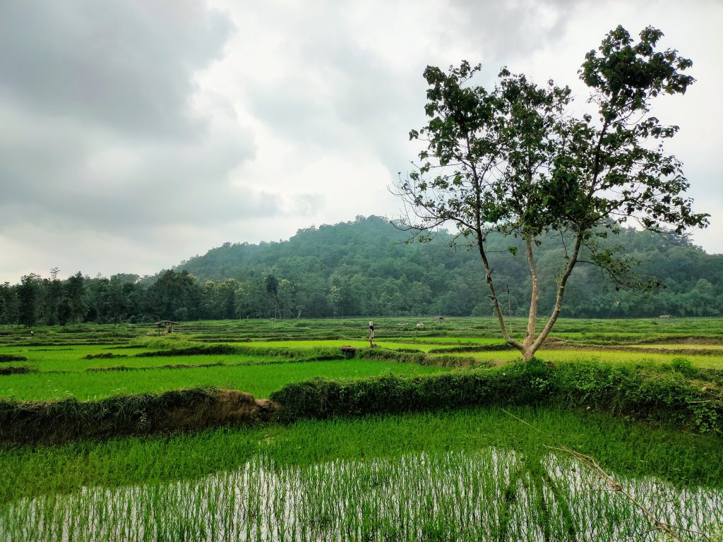
Several corridors in India are a mosaic offorests, farmlands, and plantations. This image illustrates a forest-agriculture mosaic from the Kanha Pench Corridor in Central India. Photo by: Rahul Talegaonkar
Given this intricate interplay of natural and human elements, conservation of these multi-use corridors necessitates robust partnerships among different stakeholders so that developmental goals can align with conservation goals. “Joint plans for conservation and social goals are the path forward to ensure ethical and safe passage of wildlife”, says Amrita Neelakantan, executive director of the Network for Conserving Central India.
Does India have a plan for corridor conservation? The Government of India acknowledges the importance of corridor conservation, as is evident in the National Wildlife Action Plan 2017 and in several guidelines provided by National Tiger Conservation Authority (NTCA). Notably, each tiger reserve in India must prepare Tiger Conservation Plans (TCPs) with an indicative plan for adjoining wildlife corridors. These guidelines highlight the strategies that can be used for corridor conservation. For example, they suggest that managerial approaches similar to buffer areas of tiger reserves should be adopted in the corridor areas and that “commercial mining, setting up of industries causing pollution and establishment of major hydroelectric projects, and discharge of solid wastes or effluents in natural water bodies needs to be avoided in such areas”.
To ensure effective planning in the corridor areas, the guidelines also recommend incorporating corridor-related activities in the working plans of forest divisions overlapping with the corridors as well as establishing State Level Monitoring and District Level Implementation Committees. Though such detailed guidelines do not exist for other species, most of these practices are equally valid and crucial for several species. However, depending on the species composition of the region, corridors may require some species-specific considerations, not included in the TCP guidelines, as research shows that a single species may not always effectively capture varied ecological requirements for dispersal of other sympatric species.
While there are guidelines and mechanisms for conservation planning for tiger—and to some extent elephant—corridors, a preliminary review of the plans suggests that their implementation has not been able to translate into action on the ground. These plans require further strengthening in several areas, including coordination between tiger reserves, territorial forest divisions, line departments, and infrastructure development agencies.
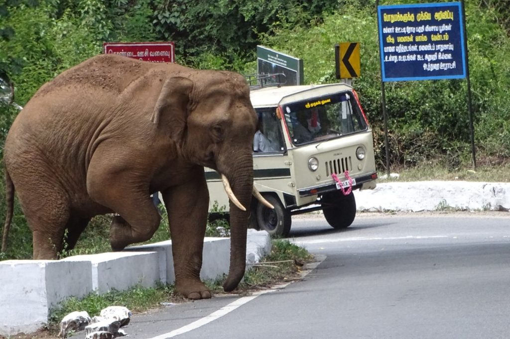
Elephant crossing the National Highway 67 located in the Kallar Corridor in southern India. Photo by: D. Boominathan
It takes a whole orchestra to plan it
Given the multi-use nature of most corridors in India, collaboration lies at the heart of effective corridor conservation. All the cogs of the different departments and stakeholders must move in sync to ensure synergy in the efforts to conserve the corridors. Understanding and mapping of jurisdictions (such as reserve forest, private land, and community land) and identifying convergence and conflicts in policies associated with these jurisdictions is critical to collaboratively advance corridor conservation. Along with the local communities, this cross-sectoral planning process needs active participation of diverse sectors including agriculture, water resource management, mining and infrastructure.
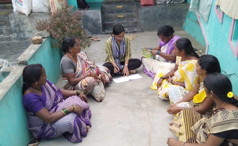
Discussion with local community members can help foster stakeholder engagement for efficient management of multi-use corridors. This photo serves as a visual representation and is intended to symbolize the broader concept and does not depict specific locations or individuals.
Recently, the Coalition for Wildlife Corridors and Madhya Pradesh Forest Department jointly organized a two-day workshop to address the need for corridor conservation planning in Central India by engaging with different stakeholders. The workshop focused on the Satpura-Pench and Satpura-Melghat corridors and convened forest officials from tiger reserves and territorial forest divisions overlapping with the two focal corridors, as well as representatives from the district administration, NTCA, NHAI, Western coalfields, other government agencies, and NGOs that work in the these corridors. “This is the first-ever attempt to bring all stakeholders together to have a common understanding of corridors and discuss streamlining of the developmental activities for the betterment of wildlife and communities,” says Mr. L Krishnamurthy, Field Director, Satpura Tiger Reserve.
Throughout the workshop, the attendees actively participated in a series of discussions on the importance of upholding ecological connectivity and the challenges faced by different stakeholders. Leveraging the diverse expertise and knowledge of the group members, the participants brainstormed innovative strategies that can strengthen corridor planning in the two corridors. This was the first in a series of workshops for conservation planning of corridors in Madhya Pradesh.
Although just the first step, such multi-stakeholder workshops are excellent forums for in-depth discussions and thoughtful dialogues, which can lead to effective corridor conservation planning. They can allow policymakers, conservationists, and other stakeholders to work in tandem to avoid, mitigate, and offset the negative impacts on corridors — in that order — to ensure the persistence of the diverse species in landscapes across India.
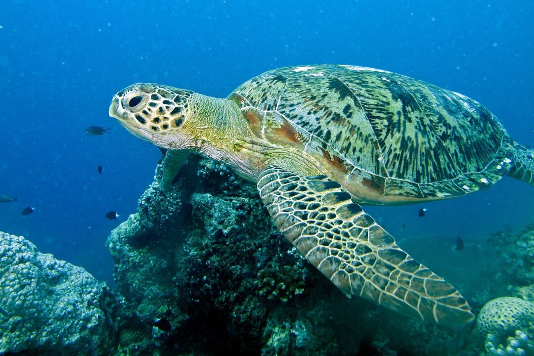
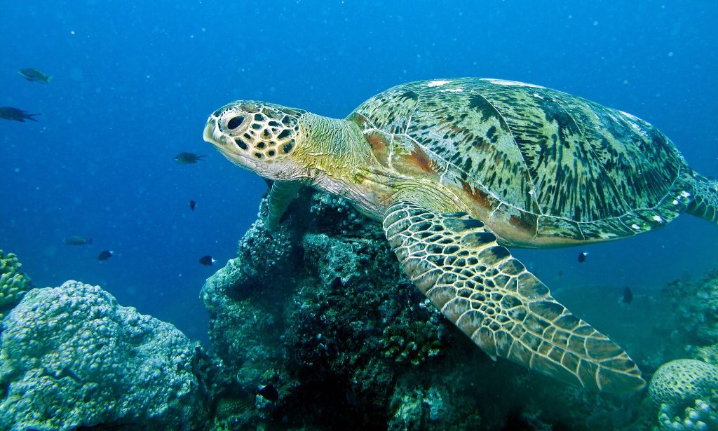
One of the largest sea turtles and a herbivore, the green turtle is widespread across the globe. Green turtles primarily feed on seagrass and algae that give their cartilage and fat the green colour. Historically, green turtles were exploited for their fat, meat, and eggs, causing global population decline. Now, many countries prohibit killing of sea turtles and collection of their eggs and have established protected areas along their coasts to protect the feeding and nesting grounds of the turtles and other marine life.
Green sea turtle. Photo credit: Bernard Dupont, via Wikimedia Commons
Similar to national parks and wildlife sanctuaries on land, Marine Protected Areas (MPAs) are nature reserves for marine biodiversity. They play a crucial role in the long-term survival of species and their habitats.
Traditionally, MPAs were not specifically planned with migration routes and connectivity in mind. However, several marine species, including green turtles migrate long distances between their feeding grounds and nesting sites. Boat strikes and entanglement in fishing gear are some of the threats that the sea turtles face while migrating long distances. Hence, assessing the connectivity across existing MPAs and identification of migration corridors are essential for ensuring the effectiveness of the protected area networks for conservation of marine species.
A recent study, published in the Frontiers in Marine Science journal, investigated the connectivity between marine protected areas in West Africa. This region, along the coasts of Guinea-Bissau, Senegal, the Gambia, and Mauritania, hosts rich coastal ecosystems including seagrass meadows, mangroves, and tidal flats, and is home to the largest population of green turtles in the eastern Atlantic Ocean. One of the core nesting sites for the green turtles in this region is the island of Poilão which lies in the Bijagós archipelago off the coast of Guinea-Bissau, where thousands of turtles nest every year.
During the nesting season in 2018, the researchers attached satellite tracking devices on 45 green turtles in Bijagós archipelago, Guinea-Bissau, and tracked their movements over two years. They divided the movement behavior into three distinct periods: inter-nesting (the duration between consecutive nesting events in a season – females lay eggs 3 to 6 times in a single season!), migration (the movement after nesting to foraging grounds or post-foraging to nesting grounds) , and post-nesting foraging (when they are primarily foraging and not breeding).
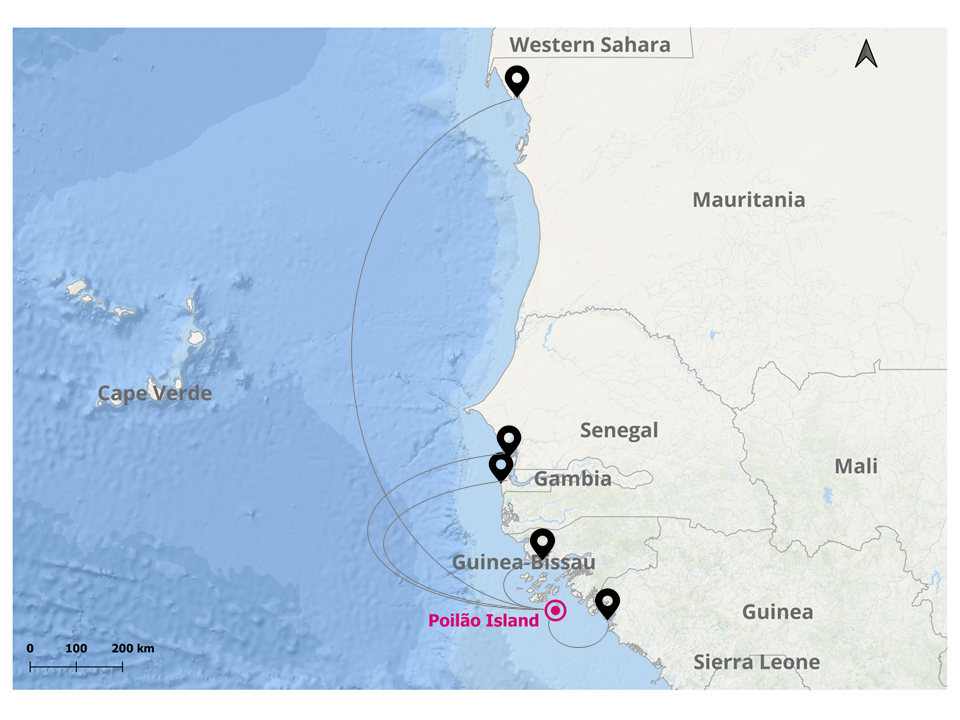
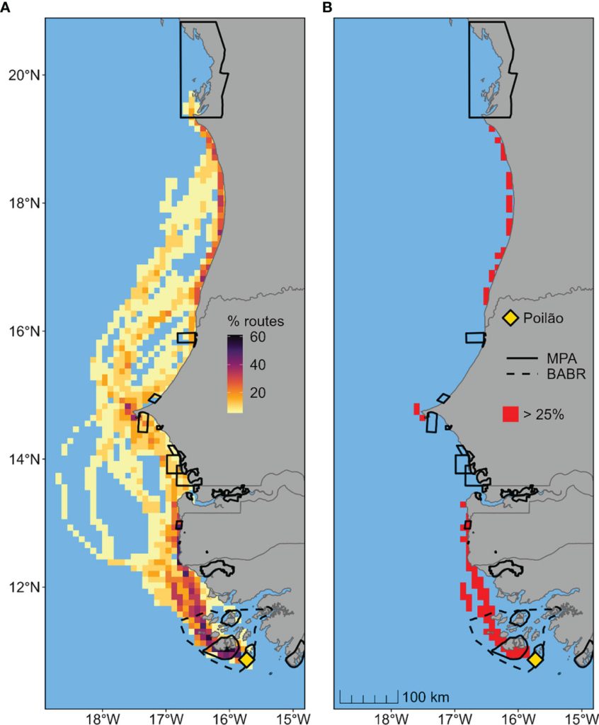
The researchers found that during the inter-nesting period, the females spent most of their time around the nesting sites and 95% of their movement was restricted to the MPA that covered the nesting sites. Post the nesting season, some turtles migrated hundreds of kilometers away from the nesting sites, while some others remained around Guinea-Bissau throughout the year. Thirteen of the tagged turtles traveled as far as 1,000 km. north of the Bay of Arguin, in Mauritania. During migration, most turtles followed the shoreline, while some of them traveled several hundred kilometers offshore. None of the migratory turtles stopped within the archipelago for foraging during their migration. Only 21% of the areas used by migrating turtles overlapped with the MPAs in the region.
Feeding grounds of the West African green turtles
The study also investigated the movement patterns of turtles as they searched for food after nesting. Most of the turtles that migrated to Senegal, the Gambia, and Mauritania spent most of their time (78%) in the MPAs of those countries while foraging.
The study found that the migrant green turtles from Guinea-Bissau connect at least five West African nations. Overall, the nesting and foraging grounds of the turtles are well-covered by the existing protected areas. However, most areas used for migration, the migratory corridors, are not a part of the network. Since migration is seasonal, the authors of the study suggest implementing seasonal, region-specific bans on fishing practices that often cause turtle bycatch mortality.
Beyond green turtles, the findings of the study have important implications for marine spatial planning and the conservation of marine biodiversity in West Africa. While the study highlights the importance of MPAs for the conservation of marine species, it also emphasizes the need for international collaboration and information exchange for the effective conservation of migratory species. The findings of this study can be relevant and informative for policymakers, researchers, and conservationists in other regions facing similar conservation challenges.
Technical summary of the analysis methodology
For the identification of the migratory corridors, the authors used the data from the tracking devices and a movement modeling-based approach called the dynamic Brownian bridge movement model (dBBMM). This modeling approach incorporates temporal and behavioral characteristics of movement paths for estimating migratory corridors and home ranges. The movements of the 45 turtles tracked during the inter-nesting period from August to early December were used to analyze their home ranges and core-use areas using a Kernel density estimation (KDE) technique which plots the extent of the locations where the turtles were found to create a boundary. The KDE’s maps were used to identify the areas that the turtles use the most. This was combined with the dBBMM outputs showing the important pathways between protected areas.
Figure (from the paper): The migratory routes of female green turtles traveling from the nesting island (Poilão) in Guinea-Bissau to foraging areas. (A) Percentage of overlapping migration routes, defined as 95% probability areas estimated using dynamic Brownian bridge movement models. (B) Identified high-passage corridors, defined as grid cells used by at least 25% of migrating turtles. Black solid and dotted lines represent existing conservation areas in the region.
This piece is based on the following study:
A. R. Patrício, M. Beal, C. Barbosa, D. Diouck, B. J. Godley, F. M. Madeira, A. Regalla, M. S. Traoré, C. Senhoury, E. Sidina and P. Catry. (2022, March 31). Green turtles highlight connectivity across a regional marine protected area network in West Africa. Frontiers in Marine Science, Volume 9. https://doi.org/10.3389/fmars.2022.812144
Welcome back to Corridor Conversations, and the final interview in our series on women working in connectivity conservation.
Today, Harshad Sambamurthy speaks with Ms. Aradhana Sahu, IFS Officer(2003), Chief Conservator of Forests (Junagarh Wildlife Circle), Gujarat Forest Department.
How has your journey in conservation been thus far? What drew you to this field?
As a botany student, my fascination with the world of plants and animals has always been what has motivated me to pursue a career in this field. I have spent the majority of my childhood in the tribal areas of Orissa. I grew up in a forest area, (as my father was a dam construction engineer). Thus, knowledge of the natural world and of those who lived close to it came naturally. I realised that nature is the very essence of life and a means of subsistence at a very young age. Since I first joined the Indian Forest Service (IFS) in 2003 and entered the field in 2005, I was given the opportunity to work in the agroforestry, wildlife, and high forestry sectors. Ultimately, it has been a wonderful journey with the Gujarat Forest Department so far.
Have you faced challenges as a woman working in conservation? What are some of the stereotypes you have had to fight against/ negotiate?
I have had a great time working in the conservation field. The locals (the general public), staff and officers have always been quite helpful. Nonetheless, I have to admit that the initial days were difficult. Doing fieldwork and leading various teams were some of the biggest hurdles at first, but everyone gradually warmed up. In fact, my co-workers and seniors began offering better resources and platforms. So, it was challenging to be one of the first few women in the state working in this sector, but the drive to protect the forest and wildlife made the challenges seem less imposing.
What are some valuable lessons you’ve learnt that could benefit early-career women conservationists?
I have been working in this field for the last 20 years, but it has taken decades for women to shift from being completely forbidden from pursuing careers in wildlife to being accepted as the norm. So, it is crucial to recognise the opportunities that young women are currently receiving and I urge them to never take your work for granted. Yet, there is still a long way for women to go. As a woman conservationist, the following two lessons have been really helpful to me, and I hope that they will be for other women as well:
You have to work harder than your male counterparts to be recognised in this field. This is my personal opinion.
Many of the battles are won in your own mind because the society in which we grew up probably doesn’t project many women capable of working in tough postings/ interior postings/ field postings or just doing well in male-dominated work places.
In the landscape you work in, what are some of the similarities (or differences) you have observed in how forest-dwelling communities perceive wildlife, and the shared spaces they call home?
The landscape that I currently work in is the Gir Protected Area, which is the only home to Asiatic lions. The “Maldhari” and “Siddi” are the two tribes that live in this area. These people are deeply connected with nature and the wildlife here and have a strong sense of place and belonging, and this connection is reflected in their culture. There are a lot of fascinating tales about the forest where kids play in the fields and lions sunbathe nearby in the same field. They understand that they are sharing their homeland with the big cats and they take great pride in that. In addition to this, they also participate in numerous community-led conservation activities.
What role do you think able leadership plays in ensuring equal opportunities for women?
A capable leader is one that does not take bias into account and offers practical tools and support to assist females in succeeding at the same rate as their male counterparts. The leader should help the organisation in recognising the differences between real-world scenarios and societal expectations, preventing gender-based discrimination, and moreover, not be critical of female employees who are returning to the workplace after maternity leave. Therefore, a strong leader is always useful in ensuring that women have equal opportunities.
Many a time, media coverage focuses on large mammals traversing fragmented habitat. How can we highlight the importance of connectivity for smaller species?
It seems to me that a particular area’s flagship, keystone and/or umbrella species have been the focus of media, rather than purely a purposeful differentiation between larger or smaller animals (ecological importance of the species rather than size of the animal). Also, it is usually the large carnivores that travel long distances to find new mates, food, and territory.
These species are usually selected for making conservation-related decisions, typically because protecting these species indirectly protects the many other smaller and larger species that make up the ecological community of its habitat (the umbrella effect), and thus this umbrella species is in the media and other animals are not. So, from a conservation point of view, all species that have ecological importance should always be highlighted.
Linear infrastructure can often lead to instances of roadkill. Are there examples of mitigation measures from the areas you were posted in (or elsewhere) in Gujarat that you feel have worked and feel to be effective, and think could be used in other landscapes?
Each conservation plan is specific to the environment and the animals that inhabit it. Even so, some mitigation strategies are useful worldwide. For instance, signs have been placed in the prospective corridors warning the public of potential wildlife crossings, the speed restriction for vehicles on roads close to environmentally-sensitive areas has been set at 20 to 40 km/h, and speed breakers have been installed on those same roads. Such efforts have been effective across many landscapes.
Most corridor work in India focuses on tigers and elephants, species not found in Gujarat. Has that resulted in reduced focus on corridor conservation in the state?
Most corridor work in India focuses on tigers and elephants because they are in fact found in various parts of India and hence receive wider attention and focus from the centre, as they should. When it comes to Gujarat, it is also the only abode of the Asiatic lions in the world, so efforts or focus have never been lacking. In fact, in recent years, more and more studies have been conducted on corridors and connectivity of Gir PA. Geospatial techniques play a pivotal role in identifying important corridors and help in taking adequate conservation measures by the Gujarat Forest Department. Most times, radio telemetry data from radio-collared lions are used to estimate their home ranges and evaluate their habitat suitability preferences, and then systematically figure out the best possible route depending on their natural dispersal pattern.
What is the current status of large-mammal connectivity in your landscape? For example, sloth bear movement in the Ratanmahal-Jambughoda corridor. What does the future hold?
I previously worked in the Ratanmahal and Jambughoda landscape and we had discovered the natural dispersal patterns of sloth bears between Jambughoda, Shoolpaneshwar and Ratanmahal. They sometimes ventured out of the sanctuary. Therefore, we had taken up a project of maintaining an ecological corridor in that landscape in collaboration with a University.
Where I presently work, in Gir, various other PAs have been established near the Sanctuary. For instance, Paniya Wildlife Sanctuary (WLS), Mitiyala WLS, Ambardi Safari Park, Girnar WLS, Barda WLS. All these WLS have good connectivity with the Gir National Park and Sanctuary. The local people who have joined in as Vanya Prani Mitra (to help manage instances of human-wildlife conflict) and trackers help in spotting/managing these animals through the landscape and act as first-responders; communicating immediately with Forest Department officials. So, updates about wildlife whereabouts are provided. Hence, the future looks promising as several upcoming projects about lions highlights the importance of much-needed safe passage for other wildlife as well. Additionally, because of the Forest Department’s consistent awareness campaigns, even the locals of the landscape are aware of the value of corridors.
What are the foreseeable challenges in maintaining habitat connectivity? Realistically speaking, can they be maintained in the long-term, or is the arm of socio-economic development bound to cut through this longevity?
No matter how many times we check the weather, it can change within the hour. Similarly, just when we think we understand wildlife conservation, we are exposed to some new behaviour and our thinking is completely altered. Science is constantly evolving and so are people. I think there are, and always will be, challenges in this field. As habitat continues to be fragmented, degraded, and lost to development, the need for a coordinated connectivity network is growing. Better habitat connectivity will allow wildlife to migrate and disperse with the changing seasons, boost biodiversity and resilience in degraded ecosystems, safeguard genetic flow between populations, and ensure species are better able to adapt to our changing climate. Sustainable practices are the need of the hour, smart investment in habitat connectivity projects will help connect protected landscapes in the long-term.
With corridors not recognised as a legal category, how does the Forest Department navigate that space? Is there internal clarity/ policy in place? What are some of the challenges here?
The Department relies on the natural dispersion patterns of lions. We have a High-Tech unit at Sasan-Gir where constant monitoring of the radio- collared animals is being done. This data along with the valuable input from the locals on the whereabouts of the lions are highly useful in establishing connectivity for wildlife here. Recently, one male Asiatic lion started naturally dispersing towards the Barda Wildlife Sanctuary and reached the Sanctuary on the night of 19th January 2023. The team of forest staff then continuously tracked and monitored the individual. Local people also informed the forest staff about lion sightings when it crossed roads. Staff also found pug marks in the reserved coastal forest also. The Porbandar Forest Division staff deployed camera traps to confirm the lion’s presence.
As the individual was in proximity of Porbandar city and to avoid any conflict, a rapid response team was made by Porbandar Forest Division to continuously check the individual’s movement. Therefore, to avoid any mishap, awareness sign boards and vehicle speed control measures were taken. As people were new to the presence of a lion in their area, it was crucial to spread awareness and sensitise them. The Porbandar Forest Division staff took the help of various stakeholders to spread awareness among the local people. The awareness materials were distributed in the lion movement villages. The help and support of local NGOs were also taken. The people were also sensitised regarding beneficiary-oriented schemes (Machans, cattle kill compensation, the construction of parapet walls around the open wells, etc.) of the Gujarat Forest Department. So, although there is no specific law or policy regarding wildlife corridors, stringent measures are taken to protect the animal. Challenges would be the attitude of the local people towards wildlife. Thankfully, the people of Gir PA have revered the wildlife here as a God-given entity and have always been cooperative, but there have been instances of harassment and retaliatory actions which can occasionally be a problem.
How can we map wildlife connectivity in a future that is likely to have more humans, and therefore more human-wildlife interactions? Is that a disaster waiting to happen or a global case-study in co-existence?
Overlapping boundaries of forests and human communities have many times resulted in the occurrence of human-animal conflict/interaction. What I have observed so far is that it is not merely the presence, absence, or number of people, but it is the utilisation of the same landscape over the same time which is crucial in wildlife-human conflict management; so definitely more case studies will contribute towards better co-existence of both.
Welcome back to Corridor Conversations, and the next interview in our series on women working in connectivity conservation.
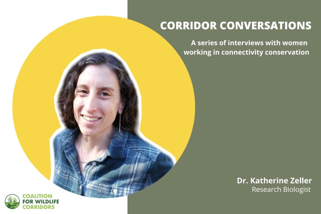
Today, Harshad Sambamurthy speaks with Dr. Katherine Zeller, Research Biologist with the Aldo Leopold Wilderness Research Institute.
Dr. Katherine Zeller
How has your journey in conservation been thus far? What drew you to this field?
I feel incredibly lucky to have had the opportunity to work in different parts of the world, with different species of wildlife, and on important conservation questions. And in my current position, I get to work on research questions related to wilderness and other similarly protected areas, which is very rewarding. I was drawn to this field from almost the moment I set foot in Alaska. I was there for my first field technician job after I obtained my B.S. – it was my first experience with truly large and wild places (along with truly large wildlife!) – and I was immediately hooked. From that point on, I knew I wanted to work in, study, and maintain these large wild places. That began my journey studying large scale conservation networks and spatial ecology, a large part of which is assessing connectivity and wildlife corridors.
Have you faced challenges as a woman working in conservation? What are some of the stereotypes you have had to fight against/ negotiate?
I think women in many STEM fields can relate to the sexism that is inherent in science, and I have certainly faced challenges in my career. Representation of women and other underrepresented groups in conservation is, thankfully, growing, but earlier in my career I was often the only woman on research teams. My contributions were often dismissed or ignored, forcing me to work harder for my ideas to be heard and for team members to regard me as a peer and respect me.
What are some valuable lessons you’ve learnt that could benefit early-career women conservationists?
For me, I found women mentors to be extremely valuable. They taught me lessons they learned through their own experiences and were great sounding boards for questions or advice. It is always nice to have someone to talk with who has had a similar path and can relate to your experiences.
I also found that, if you can build a good community of people to work with who respect each other, that goes a long way for supporting each other’s work and elevating each other’s accomplishments. For example, many times when women propose ideas, they aren’t really heard, or don’t immediately get taken seriously. Having people who support you and your contributions and who can amplify your voice in a room (and vice versa) is incredibly valuable and can shift negative power dynamics.
Lastly, I feel like we don’t take enough time to acknowledge and celebrate accomplishments. There’s a sometimes overwhelming amount of work to be done in the field of conservation so often we just move onto the next project, but there is such value in taking some time to celebrate accomplishments and wins – no matter how small. We should all be proud of the work we’re doing.
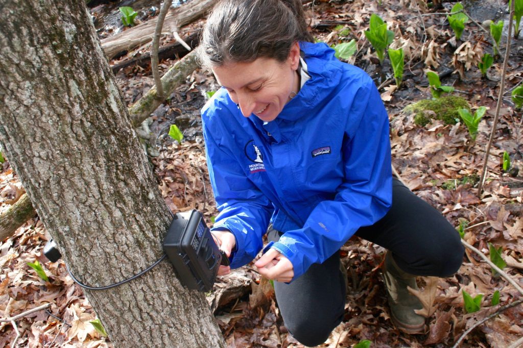
In the filed, gathering data from a camera-trap
In your research, what are some of the best-practices you’ve identified for assessing connectivity and mapping corridors?
I’m glad you asked this, because this question has actually inspired a lot of my research. In the early to mid 2000s, I was working on the Jaguar Corridor Initiative, using the best-practices at the time to model jaguar connectivity. We were mapping connectivity at broad scales — across the entire range of the species. Before on-the-ground implementation work was initiated, I wanted to obtain some field data to validate these corridors. Essentially, I wanted to be sure that the mapped corridors were actually the best places for jaguar connectivity and that we were spending conservation dollars wisely. When I started to conduct the field validation, we were sometimes finding that the mapped corridors didn’t align exactly with what we were finding on the ground. This is not totally surprising since the broad scale corridor models might not totally reflect reality, however, it did raise a red flag for me. Many conservation organisations at the time were using similar corridor modelling techniques and I was worried that conservation dollars weren’t going towards the best areas for maintaining connectivity. It actually inspired me to go back to school to obtain my Ph.D. to study this very question. We still don’t have a definitive answer, since we couldn’t look at every corridor model for every wildlife species and in different study areas, but what we’ve learned so far is that corridors modelled from GPS collar data, tend to capture animal dispersal routes better than corridors modelled from other data types. This is closely followed by using genetic data, which is followed by simple presence/observation data. In terms of the specific corridor model used, we’ve found models based on cost distance algorithms, like resistant kernels, sometimes outperform those based on circuit theory, like CircuitScape. But again, much more research is needed before we have any real rules of thumb that can be applied across species and situations. Plus, new methods are continually being developed, so it remains an important question and one I continue to explore in my research.
As you know, maintaining corridors can help connect habitats and populations so that they are less genetically isolated from one another; leading to overall increase in the robustness of a given species’ gene pool, and the overall area available to them. Species have sometimes been rescued from isolation through translocation of animals. In your experience, are there examples of establishing corridors that have aided in genetic rescue?
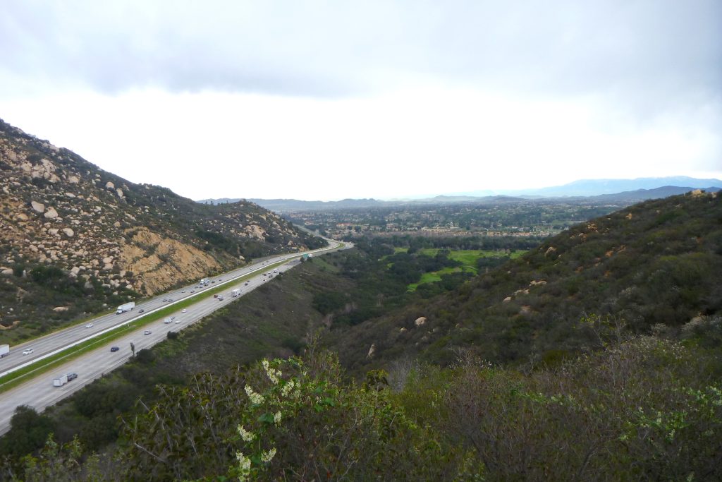
There are certainly studies that have demonstrated gene flow through corridors and road crossing structures. This question made me think of the population of mountain lions that I studied for my Ph.D. It was a relatively small population in southern California, right between L.A. and San Diego, so it was isolated from other mountain lion populations in the region by a lot of development. With only about 20-30 cats in this area in any given year, they were starting to show signs of inbreeding — both through their genetics and outward physical characteristics like kinked tails. The problem was that no new genes were making their way into the population because mountain lions from surrounding populations were not able to immigrate in. But then, one cat, M-15, finally did and just by the successful dispersal and breeding of this one male into this population, inbreeding declined, and genetic rescue was documented. Now, there are efforts to build a crossing structure for wildlife across one of the 8-lane highways that border this population. A crossing structure such as this, with appropriate fencing, will help wildlife move into and out of this area and help maintain mountain lion and other wildlife populations without the need for translocation of animals.
The last best chance at connecting the Santa Ana mountain lion population to other populations in southern California. This freeway is a stretch of Interstate 15 south of Temecula, CA (Image Credit: Katherine Zeller)
Your research in jaguar connectivity across the big cat’s entire range led to the establishment of the Jaguar Corridor Initiative. Can you tell us more about the initiative and the value of mapping connectivity across the entire range of a species?
The Jaguar Corridor Initiative (JCI)was born out of ideas of lots of people concerned about the trajectory of this species. First, there was a range-wide exercise in late 1990s, led by Eric Sanderson and others at the Wildlife Conservation Society that looked at where important populations of jaguars were, and how representative these populations were of different geographic regions across the range. From this information, they prioritised the conservation of these populations for the first truly range-wide assessment of this species. Not long after this exercise was done, a jaguar genetic study came out by Eduardo Eizirik and colleagues that showed there was a good amount of genetic exchange across the range of the species, indicating jaguars were regularly dispersing among populations and maintaining genetic viability. This was a lightbulb moment for Alan Rabinowitz, who realised, to truly conserve this species, movement routes or corridors needed to be maintained along with the populations. I then modelled the JCI, bringing together all of these ideas into a single conservation network for the species and highlighting priority areas for conservation for both jaguar populations and corridors. The value of taking this birds-eye view across a species range is that we’re able to identify important areas at this larger scale that you might otherwise miss at smaller scales – say a key corridor that might be the only link between populations in Central and South America, or a key population, that, if lost, will significantly impact the structure of the conservation network.
Linear infrastructure can often lead to instances of roadkill. What are some of the mitigation measures you feel to be effective, and think could be used in other landscapes as well?
There have been many studies done on this, and for large mammals at least, the evidence points to crossing structures, either underpasses or overpasses, built with fencing directing animals to the structure to be the most effective mitigation measure for getting wildlife safely across a roadway and keeping motorists safe. Various studies have looked at the effectiveness of these configurations and have shown that they can be over 80% effective at preventing wildlife vehicle collisions. In some study areas, for ungulates, the effectiveness can be over 90%, which is really promising. Other mitigation tools, like reducing vehicle speed limits, or large animal detection systems, have not been as effective. Wildlife crossing structures with fencing can be used in many landscapes and are, in fact, being implemented in many places around the world.
A lot of research and conservation efforts are focused on umbrella species, often large mammals, and their preservation. How can we highlight the importance of connectivity for smaller species?
More and more, people are recognising the importance of assessing connectivity at multiple scales, from the larger scales that are more appropriate for species that are capable of moving long distances, to the smaller scales that are more appropriate for species that may not be able to move as far. One challenge for modelling connectivity for smaller scales is the lack of highly resolved geospatial data. Smaller species may be responding to landscape features that are smaller than the resolution of the data we can put into the models, creating a mismatch in scale of the movement process. However, things are changing, and geospatial data is becoming available at finer resolutions, hopefully making it easier to model connectivity for smaller species and more easily incorporate smaller species into connectivity planning.
In your work on road ecology, you have used movement and genetic data to identify road crossing hotspots for large mammals. How easy or difficult is it to ensure that such research gets used by infrastructure engineers and planners? Are there any instances of mitigation measures being retrofitted based on research?
Some of my work has been motivated by questions that transportation departments have had regarding wildlife and motorist safety. And, some of my road ecology research has been borne out of data from GPS collared animals. From these data we can identify and model road crossing locations where mitigation measures might be successful.
Several corridors are mosaics of fragmented forests and other land uses. From your work in these multi-use spaces, do you get a sense that the importance of these mosaics for connectivity is recognised by the stakeholders?
If you had asked me this question 10 years ago, I might have had a different answer, but due to a lot of great work by scientists, non-profits, and others, I think that more and more, people understand the concept of ‘connectivity’, and that it isn’t just forest, or grassland, but as you say, a mosaic of different land cover and land use types. In fact, the importance of connectivity is now being recognised by many governments. For example, here in the U.S., there requirements to consider connectivity within different land management agencies, like the Forest Service and the Bureau of Land Management, and most recently, the Office of the President released guidance for Federal Departments and Agencies on Ecological Connectivity and Wildlife Corridors. This recognition of the importance of connectivity, from an individual landowner, all the way up to the federal government is very encouraging.
What are the foreseeable challenges in maintaining habitat connectivity? Realistically speaking, can they be maintained in the long-term, or is the arm of socio-economic development bound to cut through this longevity? We could perhaps take Brazil as an example (i.e. development of the agriculture sector vs. preservation of jaguar habitat). Any other examples you would like to highlight?
Because the concept of ‘connectivity’ can incorporate multiple land cover types, land uses, and land ownership, it is a concept that is not only difficult to communicate, but also to implement. Connectivity conservation, especially initiatives that are larger than a single road crossing location, is not like conventional protected area conservation. It takes buy-in from many interests such landowners, partners, and jurisdictions. As you point out, some of those interests are commercial – or even as straightforward as a landowner wanting to increase grazing on their land to earn a better living – so it really is a balancing act between maintaining connectivity and these interests. Realistically, sometimes that balance will fall to development and sometimes it will fall towards conservation, but the magic is in areas where a successful balance on both sides is reached.
In my experience, one example of this is the Barbilla-Destierro Corridor in Costa Rica. It is an important area for jaguar connectivity and through the hard work of folks at Panthera Costa Rica and others, it has been a really inspiring example of connectivity conservation. The corridor was facing many threats, but there are two examples that I’ll highlight. One example was the hydroelectric dam that was proposed on a river through the corridor that was to flood a main area of the corridor. Panthera Costa Rica was able to work with the energy company to direct flood mitigation efforts to areas of the corridor that would benefit from forest conservation and reforestation, thereby mitigating the effects of the flooding and maintaining connectivity in the corridor that otherwise might have been lost. Another example comes from the many dairy farmers in this area. Their problems were two-fold. First, they were having trouble with predation on their herds, and second, due to the rugged nature of the area, they were having trouble getting their milk to market and selling it for a fair price. The connectivity initiative brought many of these farmers together for the first time and they were inspired to form their own dairy cooperative – setting fair prices and working together to solve their transportation issues. They were also amenable to predator mitigation efforts that made their herds safer and healthier, increased yields and profits, and encouraged more tolerance of jaguars. In addition to working with companies and land owners, there have been many education initiatives in the corridor, bringing communities together to educate young and old about the importance of their lands to jaguars and other wildlife and increasing their sense of stewardship of the area.
Working from the national level to local residents has proven to be a successful model, but the work must be continually ongoing. In conservation, you’re never done with a project, the work will always continue, but the parameters of that work might change because new challenges will always arise.
How can we map wildlife connectivity in a future that is likely to have more humans, and therefore more human-wildlife interactions? Is that a disaster waiting to happen or a global case-study in co-existence?
I think some success stories have been the return of grizzlies and wolves to areas of the U.S. where they had been extirpated – and this is at a time when more people are living in the area than ever before. So, I think there’s a lot of hope. One exciting development for research is bringing more socio-economic data into connectivity models. Recognizing that successful connectivity isn’t only about what species need but is also about how tolerant humans might be of a species living in or passing through an area. There’s been a lot of great work done on combining wildlife ‘resistance’ to movement to various landscape features (typically the layer upon which connectivity is modeled, for example, roads might have a high resistance, whereas forests have a low resistance), with ‘anthropogenic resistance’, that represents the impacts of human behaviors on wildlife movement. This can help identify areas where different mitigation or restoration efforts might be needed and what approaches to promote co-existence might be most successful in an area.